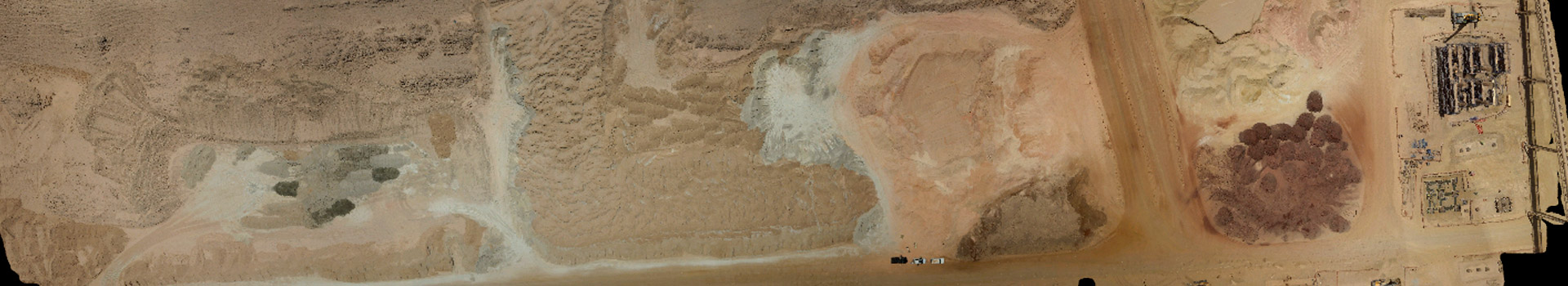
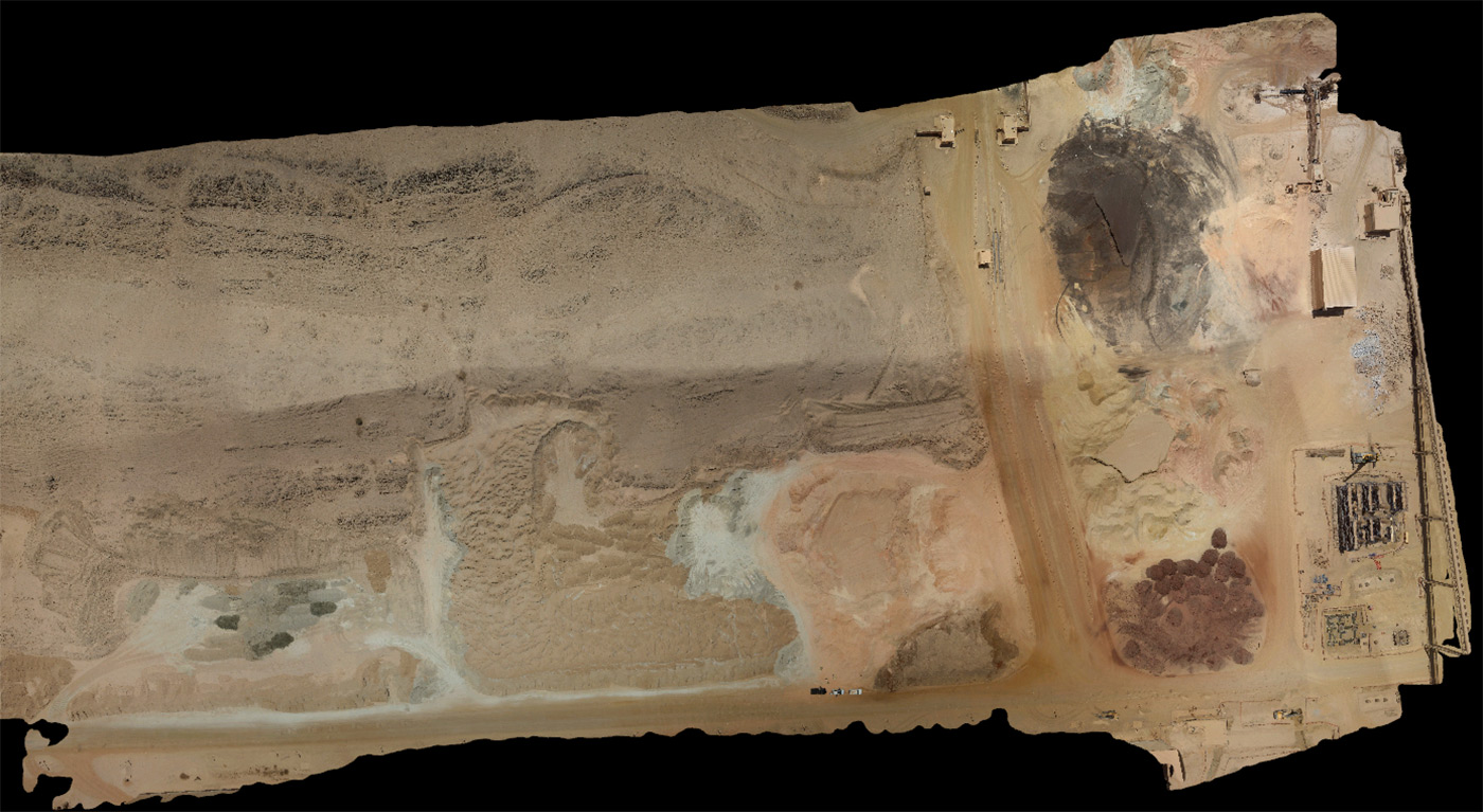
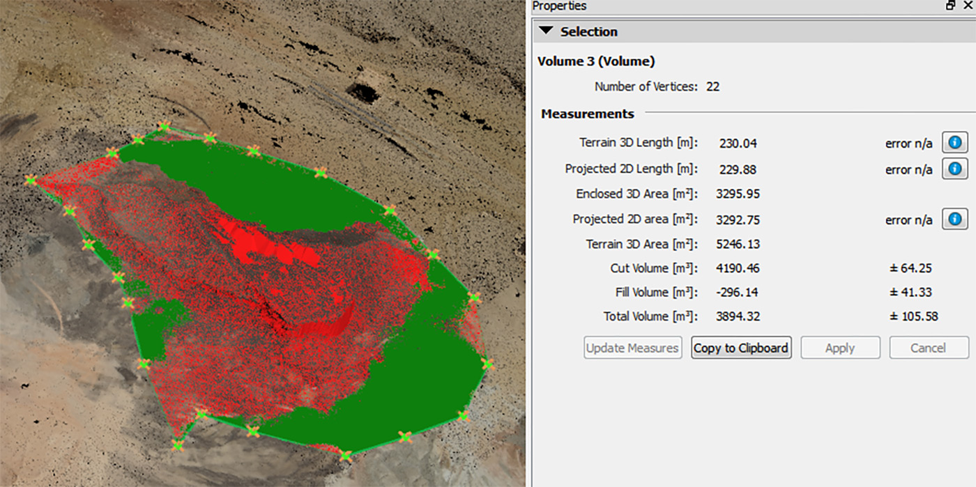
Volumetric analysis of aggregates and stockpiles by UAV is now a standard practice: besides the speed and accuracy advantage, UAVs can easily reach areas that are difficult or dangerous for land surveyors to access, providing our clients an extra layer of safety. Typically FalconViz UAVs can capture up to 500,000m² per day at 1.0cm resolution. When it comes to quarries that are greater than 1km² our FVJET can capture 3km² per hour at an accuracy of 3.5cm (2.0cm GSD).
Deliverables
- 2D as-built CAD Drawings
- 3D as-built CAD Drawings
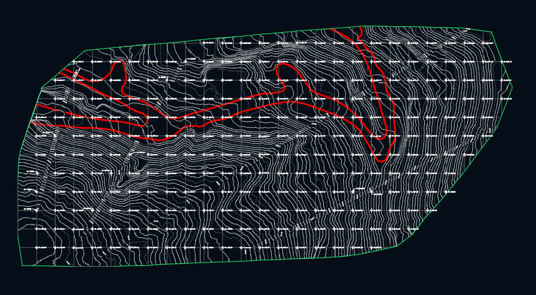
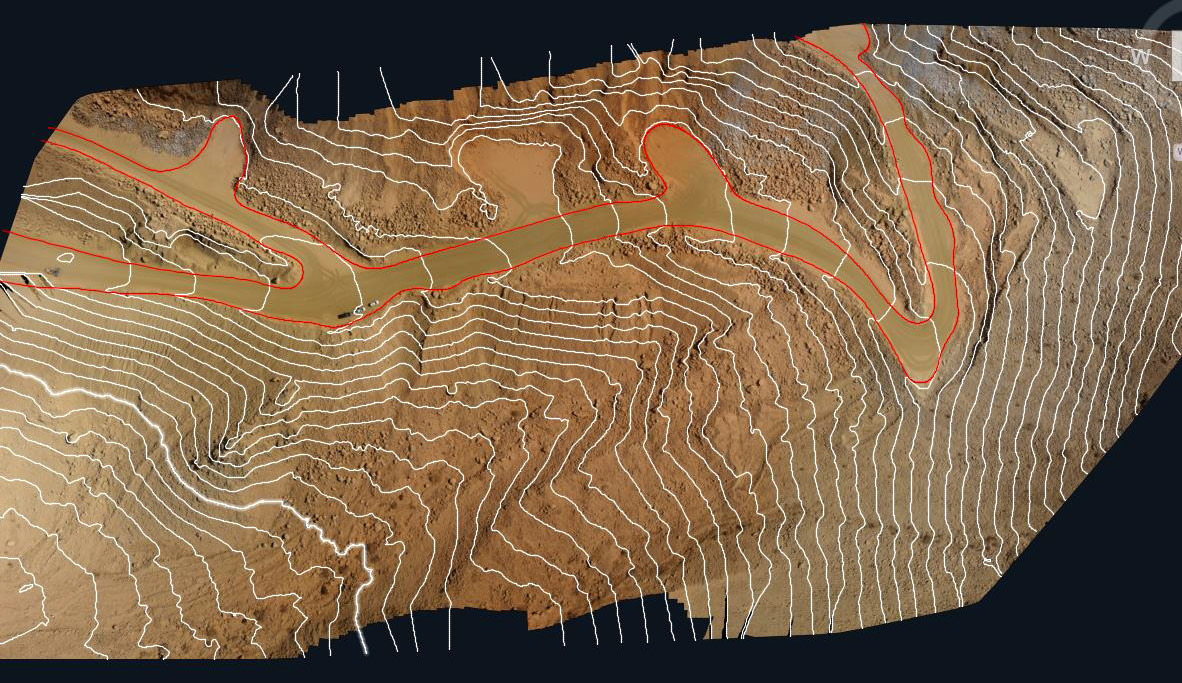
- Contour Line
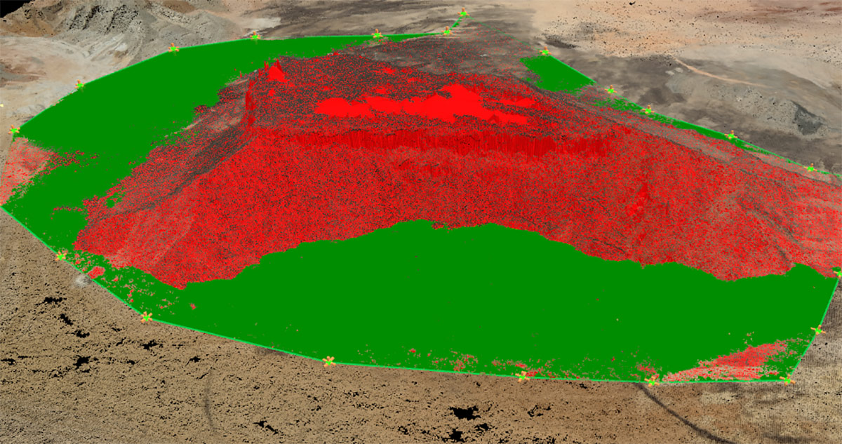
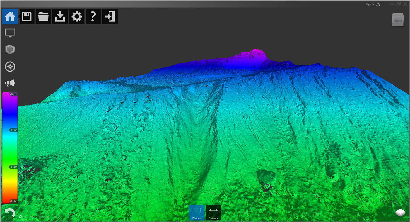
- Digital Elevation Model (DEM)
- Digital Terrain Model (DTM)
- 3D HD Model
- 3D Walk Through
- 3D Fly Through
- True Orthographic Photography
- HD Areal Photography
- HD Video shooting
Clients
- 3D as-built drawings
(up to 0.5 cm accuracy) - 500,000 m² per day
- Volume assessment for stock
- Low cost areal monitoring / imaging
- Inexpensive monthly charge
GET A QUOTE
Samples


KEEP IN TOUCH