
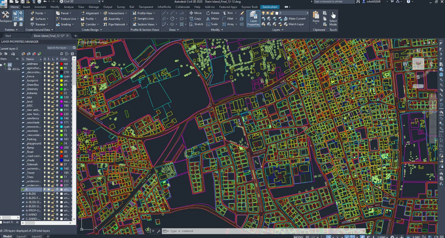
GIS & Satellite Data Processing
GIS & Satellite Data Processing

FalconViz provides large-area, stereo satellite image processing with the highest possible accuracy and resolution. We acquire the required satellite imagery from our collection of partners in the satellite imagery business: Airbus, Maxar, Planet, European Space Imaging, and Head.

We use satellite imagery to extract Digital Terrain Models and Digital Surface Models at the highest resolution. We provide our clients with both the satellite archive data and the new tasking data.
Automatic Feature Extraction
 Through our collaboration with cutting-edge partners in the EU and North America, we
leverage the latest developments in machine learning and computer vision to extract
both 2D and 3D features from remotely-sensed, high-resolution imagery
(e.g. satellite images, aerial images, etc.) to help keep your data up to date.
Hosted on a secure, and highly scalable cloud computing environment (Amazon Web Services),
we can conduct continental-scale extractions and updates in a matter of months.
Through our collaboration with cutting-edge partners in the EU and North America, we
leverage the latest developments in machine learning and computer vision to extract
both 2D and 3D features from remotely-sensed, high-resolution imagery
(e.g. satellite images, aerial images, etc.) to help keep your data up to date.
Hosted on a secure, and highly scalable cloud computing environment (Amazon Web Services),
we can conduct continental-scale extractions and updates in a matter of months.
For example, all building footprints in the US (over 169 million) were extracted in a
span of 6 months and are being updated on an annual basis. Furthermore, our software
extracted all buildings (over 415 million), road centerlines (17 million linear kilometers),
and forests (582 million hectares) across all 51 countries of Sub-Saharan Africa in just 8
months. This data on Sub-Saharan Africa has been updated twice, based on newly collected
imagery.
Our maps are leveraged globally by many organizations such as…
- National Oceanic and Atmospheric Administration (NOAA)
- World Bank
- Munich Re
- Canadian Local Governments
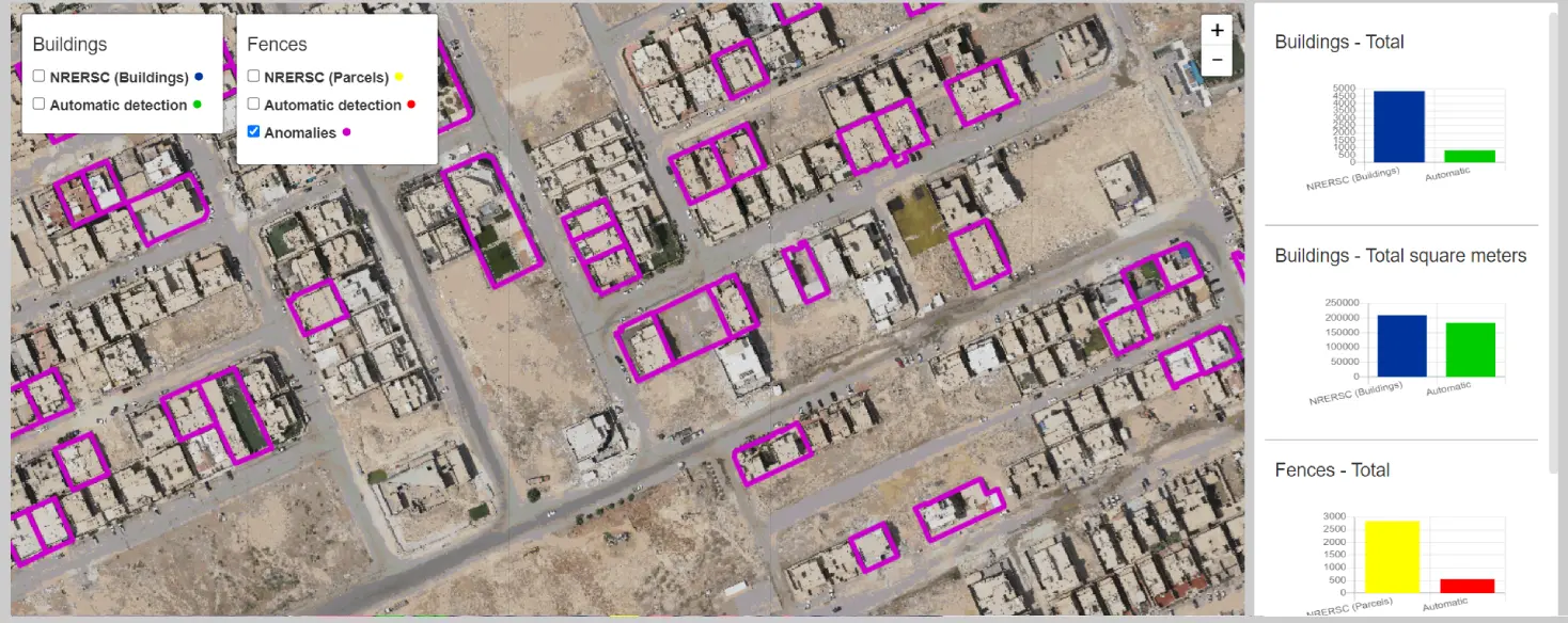
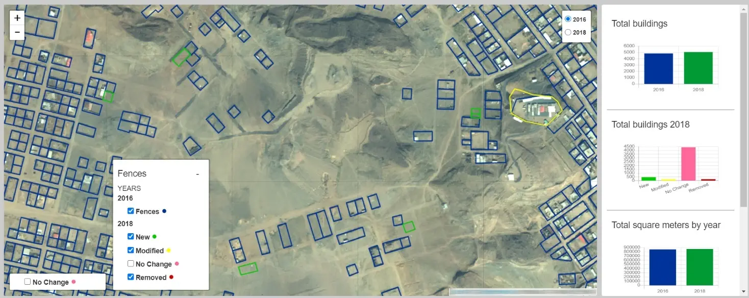
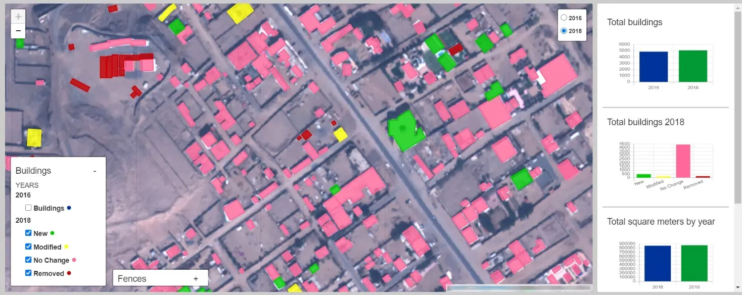
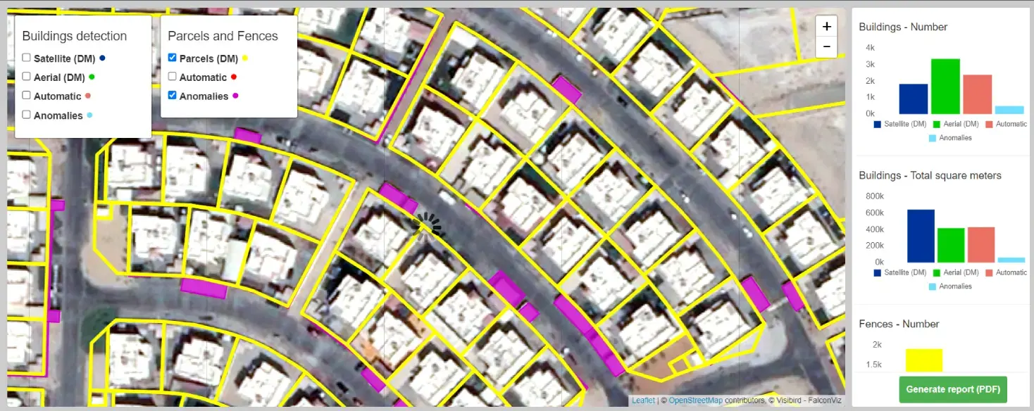
In addition to the scale and efficiency achieved, our machine learning software’s extraction accuracy has been independently evaluated by third parties on numerous occasions to have over 95% geometric accuracy with less than 5% false negatives or false positives. The images below represent a high-level overview of our extraction process.
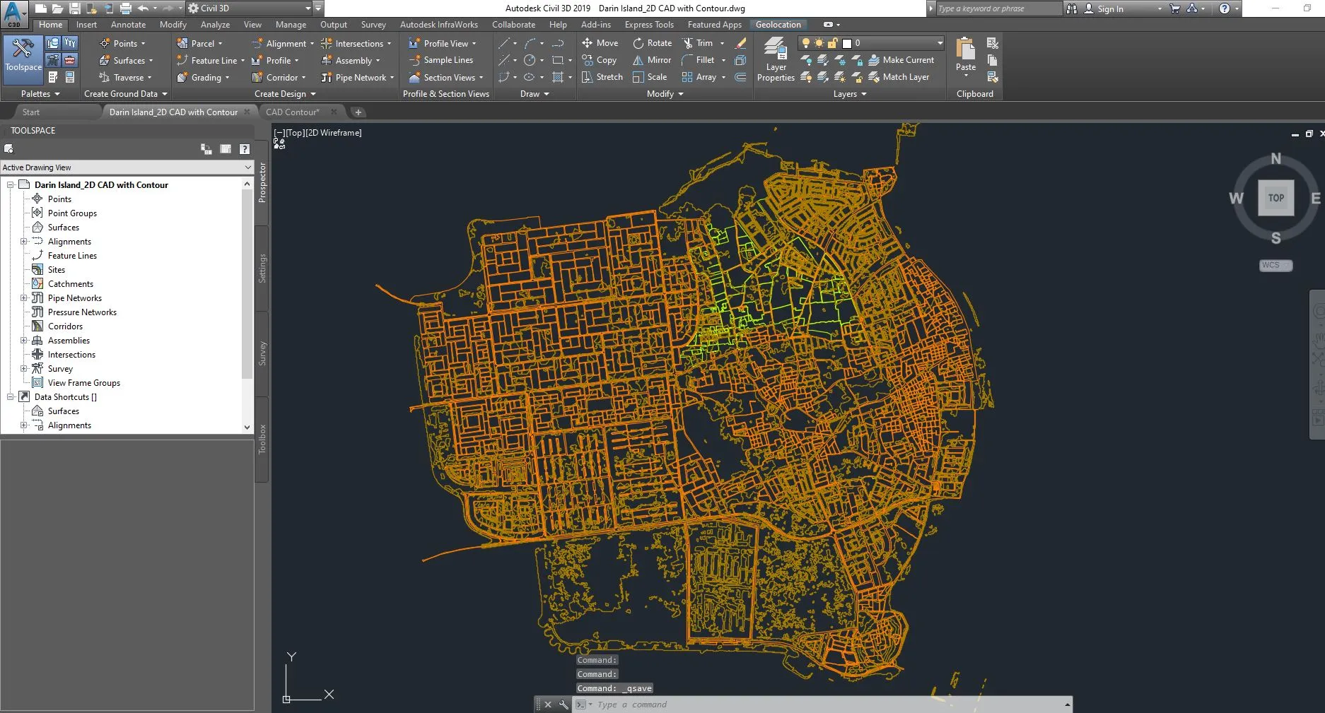
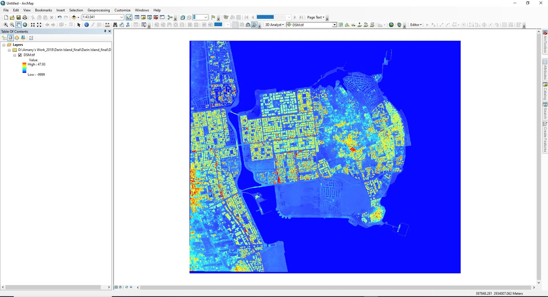
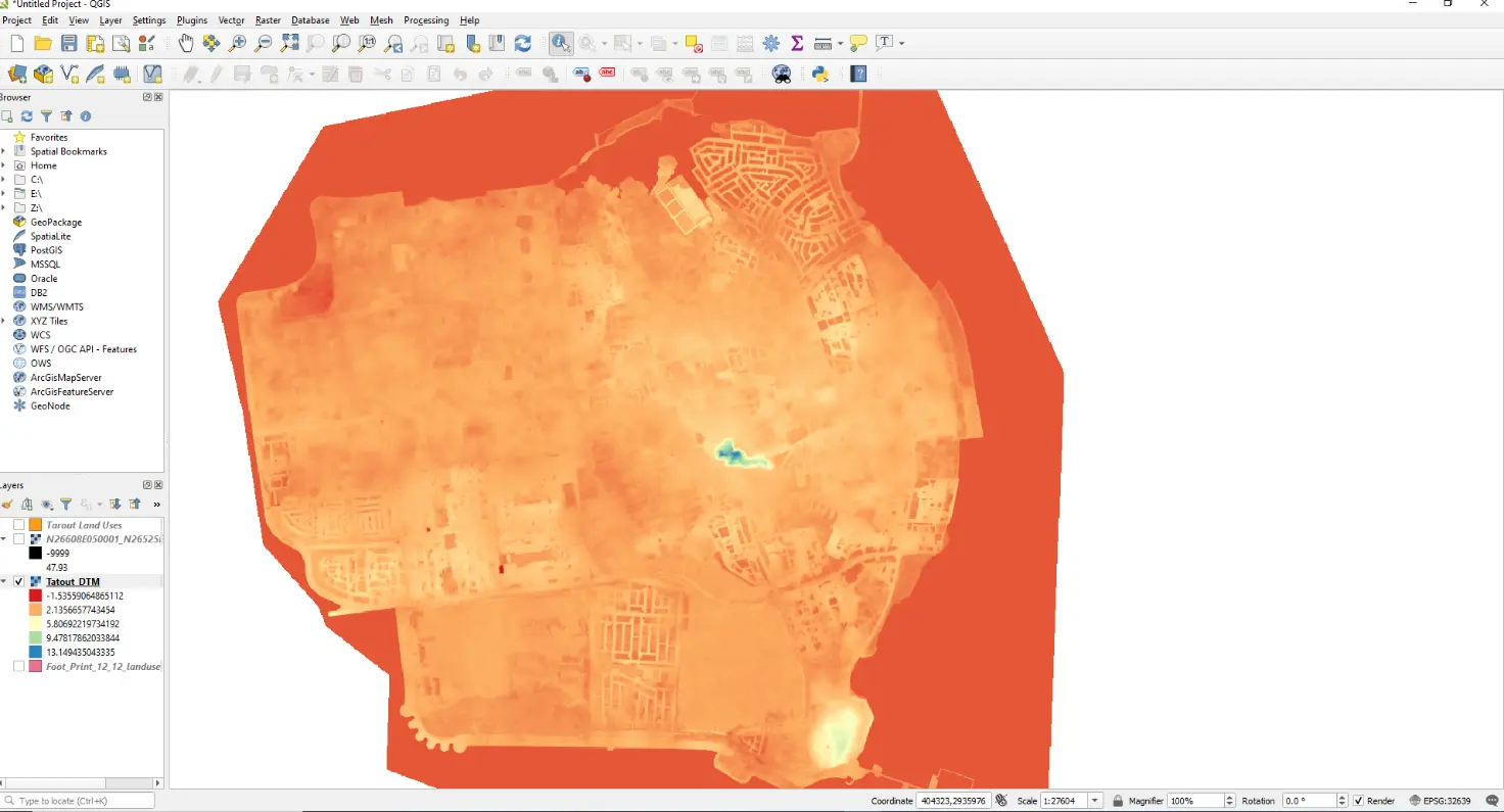
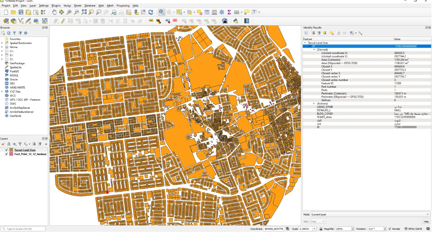
Samples from Recent Projects in KSA and UAE.
Contact us
Get a Quote
We provide an up-front quotation on your project so you’ll know the total cost without any surprises and be in control of the cost
Get Quote