
Construction
Buildings, Real Estate and Construction

 From aerial photography and videography to 360° video tours and asset digitization, FalconViz solutions make it easy to evaluate and communicate your vision to
your clients.
From aerial photography and videography to 360° video tours and asset digitization, FalconViz solutions make it easy to evaluate and communicate your vision to
your clients.
Services
- 3D Modeling and Visualization
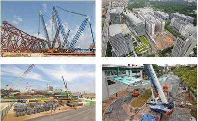
- Construction Monitoring
- Scan-to-BIM
- Topographical Surveying and Mapping
- Building Envelope Thermal Inspection
- Building Rooftop Inspection
- Indoor Mapping
- Interactive 360 Virtual Tour
- Aerial Marketing Videos
- As-Built Drawings and Modeling
- City-Wide Mapping and Modeling
- GIS Services
- Urban Interactive Visualization
- As-Built Slum Documentation
- Virtual/Augmented Reality Simulations
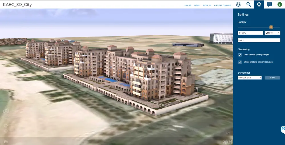
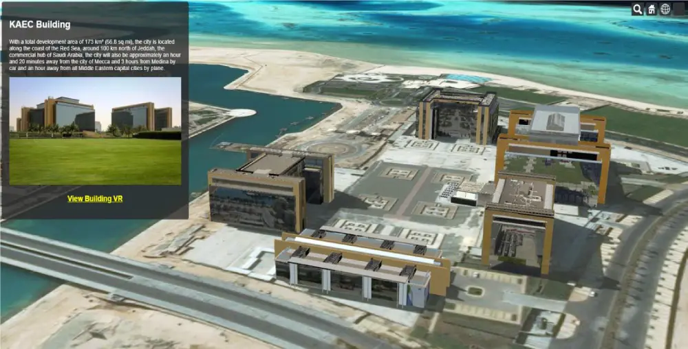
Interactive Virtual 3D Map
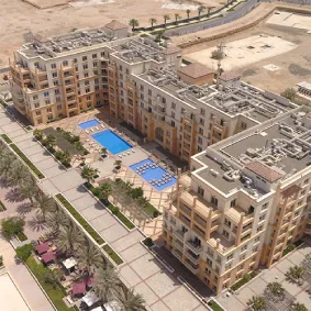
King Abdulla Economic City KAEC
This project produced an interactive 3D digital map of the entire city as a wayfinding and promotional tool for city visitors and potential investors.
King Faisal Specialist Hospital Complex
Hospital Complex in Riyadh (King Faisal Specialist Hospital Complex) (Drone scanning - exterior 3D Modeling inside Autodesk Revit - texturing - UE4 simulation)
Residential complex in Wadi Saffar
Residential complex in Wadi Saffar (3D Modeling - Texturing - UE4 simulation)
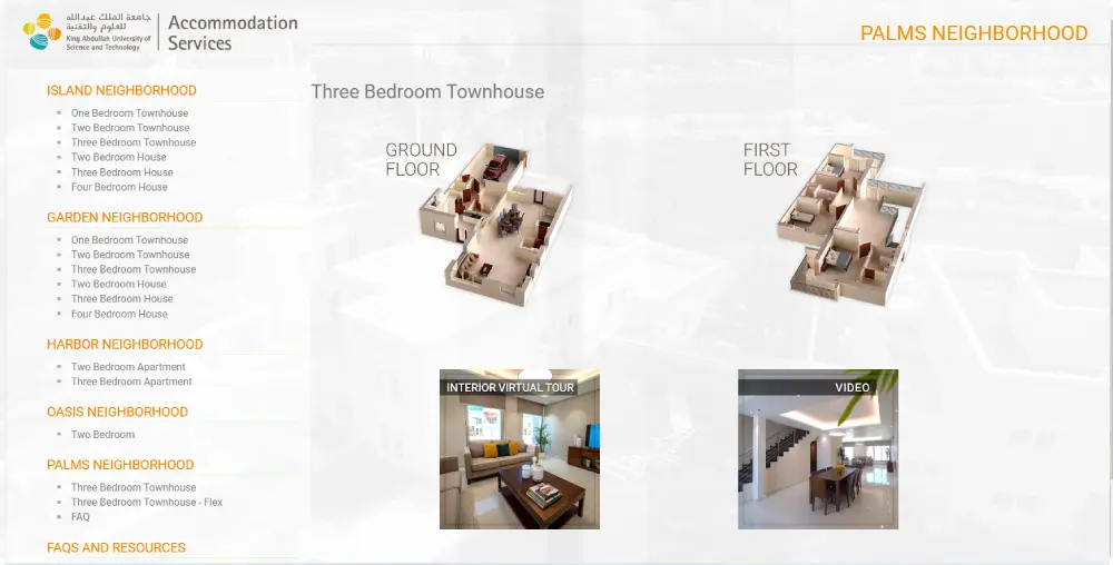
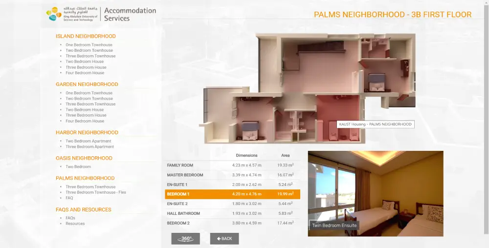
Real-Estate Website Promotion Solution
- Aerial and ground promotional video
- 3D Model of the floor plans
- 360° interior/exterior interactive panorama
- Stunning aerial/ground shots
- Static/dynamic promotional website development
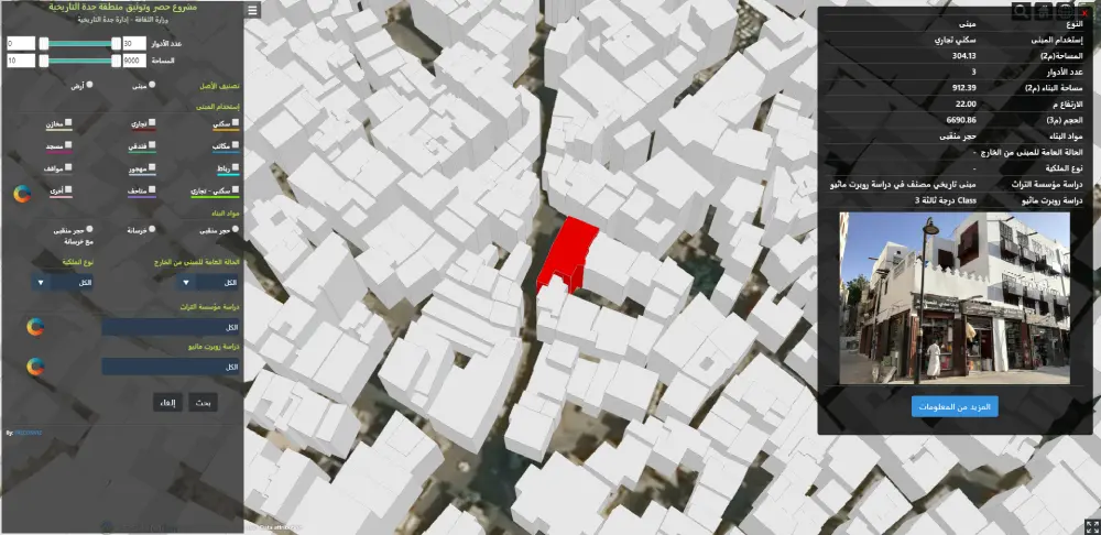
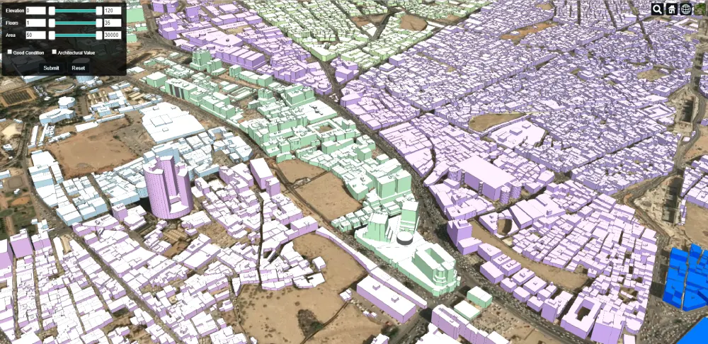
Building Asset Inventory Solution
FalconViz has built a unique building asset inventory solution based on data extracted from drones and terrestrial laser scanning data. Utilizing this data, accurate georeferenced 3D models of a building’s asset inventory are produced. Using a variety of visualization tools and techniques, we produce a secure online web application that presents your building’s data in an attractive and engaging manner. The solution includes a visual search engine that can filter the model to show buildings according to land use, area, building material type, and other features upon your request.
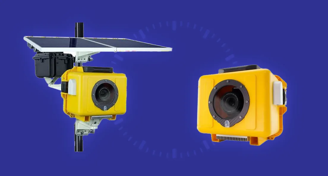
Time-Lapse Cameras
- Wireless 4G Camera Day and Night
- Online Remote Viewing on PC / Smart Phone
- IP-66 Weatherproof Housing-Withstands Dust, Rain & Heat
- Solar Power Supply + Lithium-Ion Battery
- Camera Stand Height: 8-11 meters
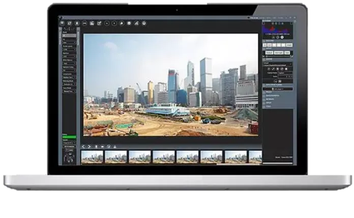
Live Monitoring & Remote Control
Admin users can watch a live feed and remotely adjust the camera settings. Login from a PC or Mac or Mobile any time, anywhere.
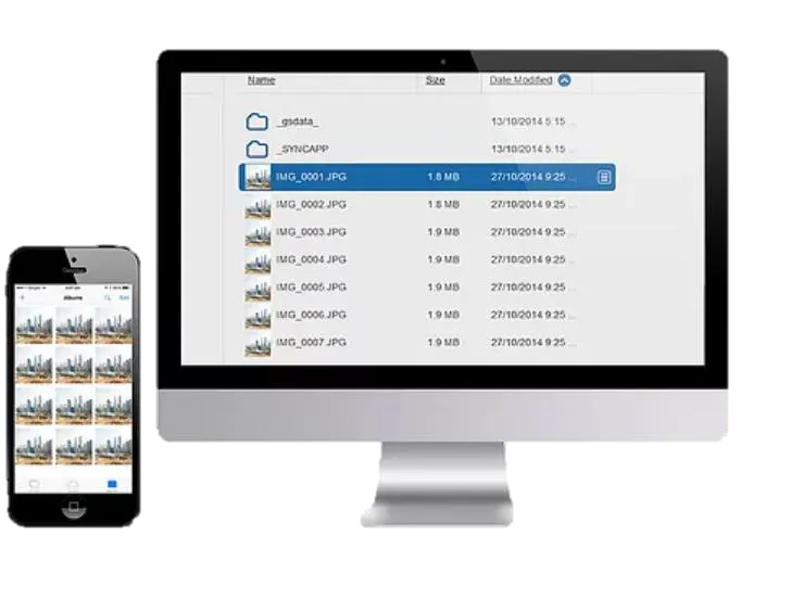
Instant Access to Time-lapse images
Sync your own server & cloud storage for backup and monitoring. Get instant access to your time-lapse images
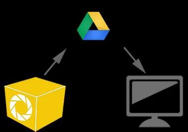
3 Data Storage Points
Since most long-term time-lapses will last several years, protecting your data and images is paramount. Captured data and images are kept on the internal computer and synced to a google drive.
Future Proof with 4K Ultra HD
Our Time-Lapse System works with any Canon DSLR to capture-high resolution photos for UltraHD 4K and beyond.
Images for Progress Reports
Beyond capturing images for time-lapse video production, the high-res photos can also be used for your work progress reports and presentations.
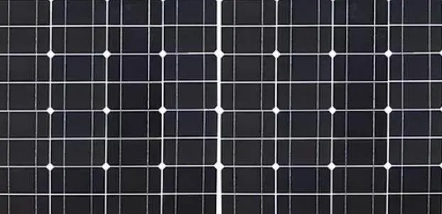
Solar Powered
Our system use the latest mono-crystalline, semi-flexible, and lightweight solar panels. These panels only need 4 to 6 hours of Sunlight to keep the system running 24/7.
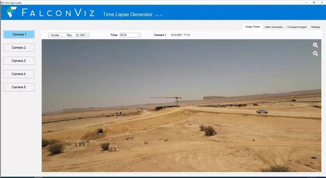
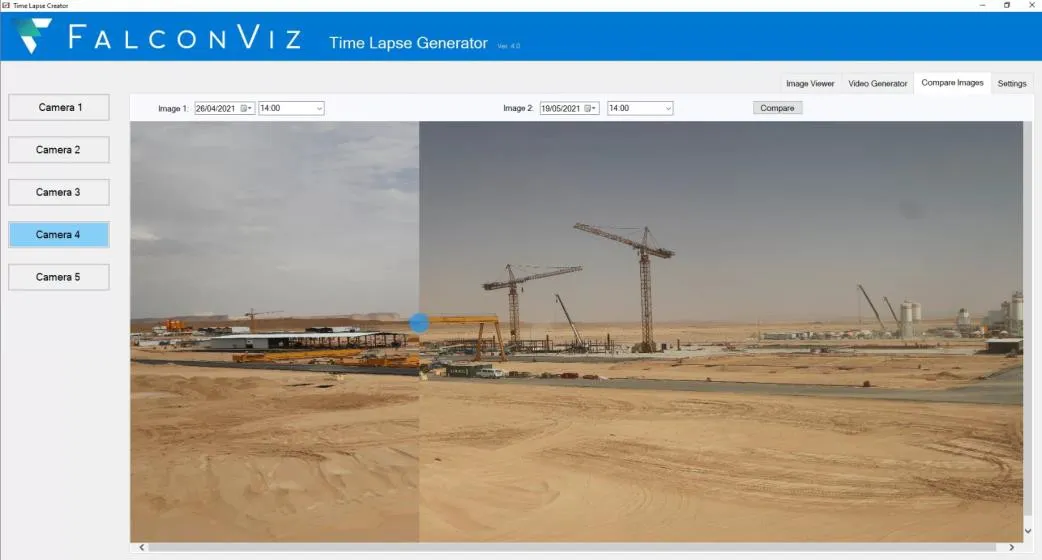
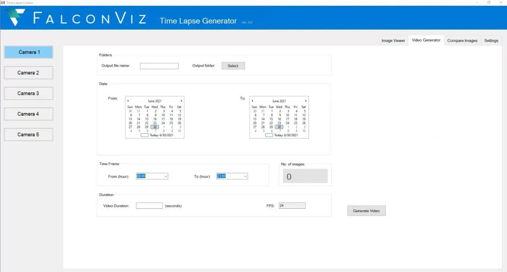
Our Time-Lapse Video Generation Application
- View images from each camera on your desktop
- Search for images by date and time
- Generate customized Time-Lapse videos over any time interval.
- Compare images from the same camera at different times
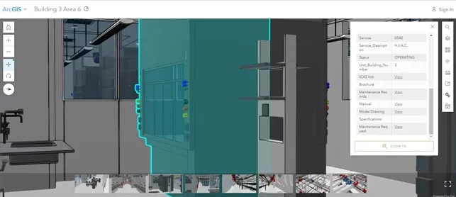
Facility Management GIS Platform
We designed and developed an online GIS Platform for the Facility Management department at King Abdullah University of Science and Technology (KAUST). The platform was built using ESRI GIS online platform technology where we integrated the 3D BIM models with the GIS and maintenance records for each building asset. The project included full digitizing services, consisting of a full laboratory scan, data processing, 3D BIM model extraction for each asset, adding related maintenance and operation records, and finally integrating the entire platform with the facility management system currently in use at KAUST.
Research Lab – Digitizing the entire buildings visible assets – Integrating with FM system
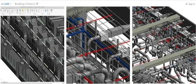
Cat Walk – Digitizing the entire MEP assets – Integrating with FM system
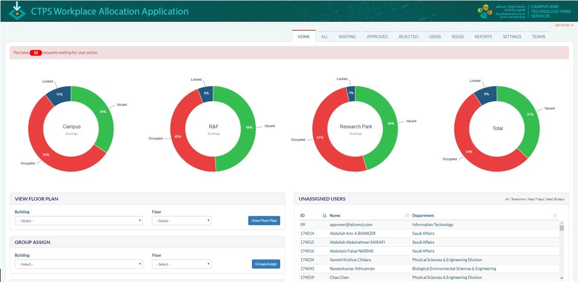
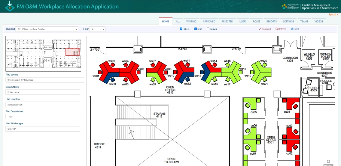
Place Mapper
(Space Management Platform)
FalconViz designed and developed a space management platform for King Abdullah University of Science and Technology. The platform is designed to manage all allocated spaces on the university campus with an intuitive dashboard to visualize space availability and the details of building occupants. The platform is designed to include all educational, healthcare, and industrial facilities.
Trusted by the Following Clients
Contact us
Get a Quote
We provide an up-front quotation on your project so you’ll know the total cost without any surprises and be in control of the cost
Get Quote