
Agriculture
Precision Agriculture
Drones have revolutionized agriculture by offering farmers major cost savings, enhanced efficiency, and more profitability. By quickly surveying vast stretches of farmland, drones can map the property, report on crop health, improve spraying accuracy, monitor livestock and irrigation systems, and more.
The ability to collect and analyze this data in real-time has tangible outcomes for farmers such as better crop yield, fewer resources expended on weeds and herbicides, and overall improved management decisions.
Crop Spraying
Seed Spreading
.webp)
Intelligent Equipment
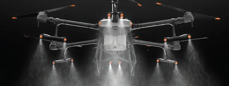
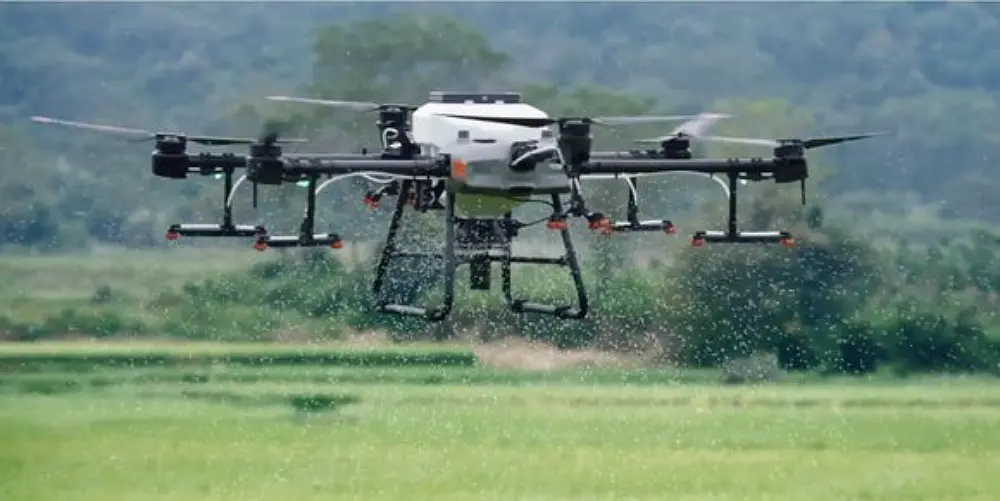
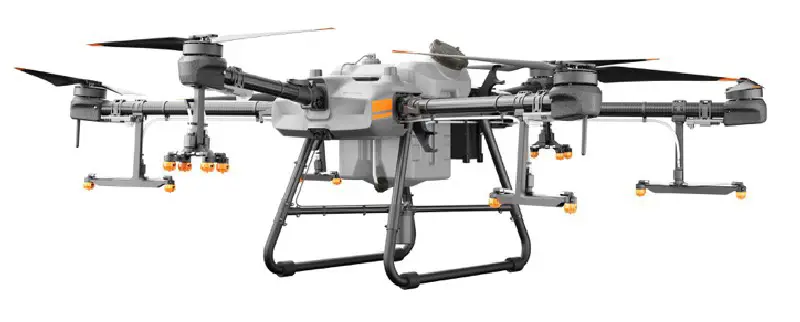
DJI Argas T30
With a 30-liter spraying tank, the DJI Agras T30 takes aerial spraying efficiency to new heights. A revolutionary transforming body enables more effective spraying, especially for fruit trees. Using DJI digital agriculture solutions, the T30 helps reduce fertilizer use and increase yield with effective, data-driven best practices.
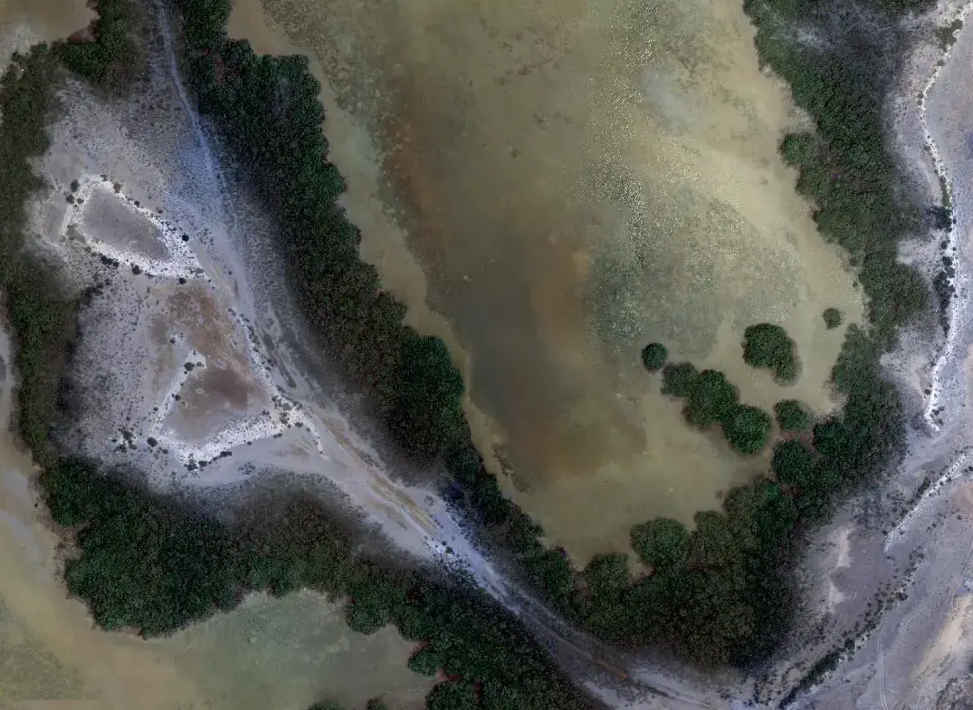
Capable Surveying Drones with Multispectral/hyperspectral Sensors
- Multispectral Sensors
- Hypersepcatral Sensors
- LiDAR Sensors
- Thermal and RGP Sensors
- Multirotor Drones
- VTOL Drones
.webp)
.webp)
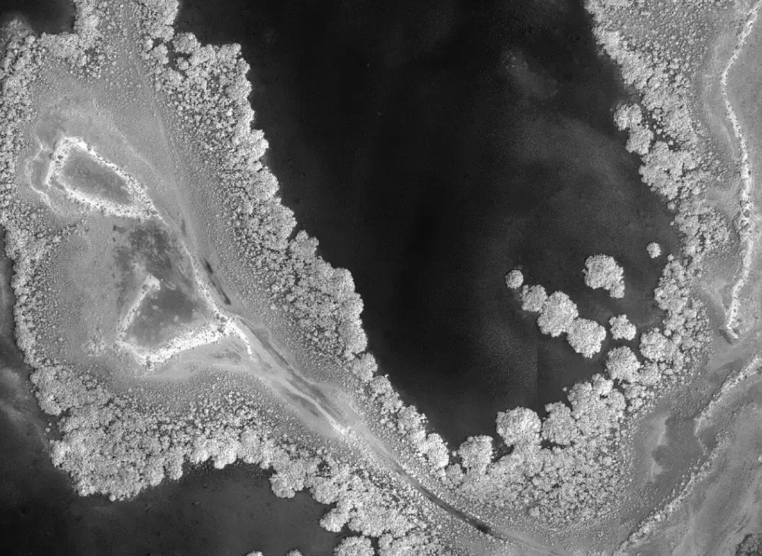
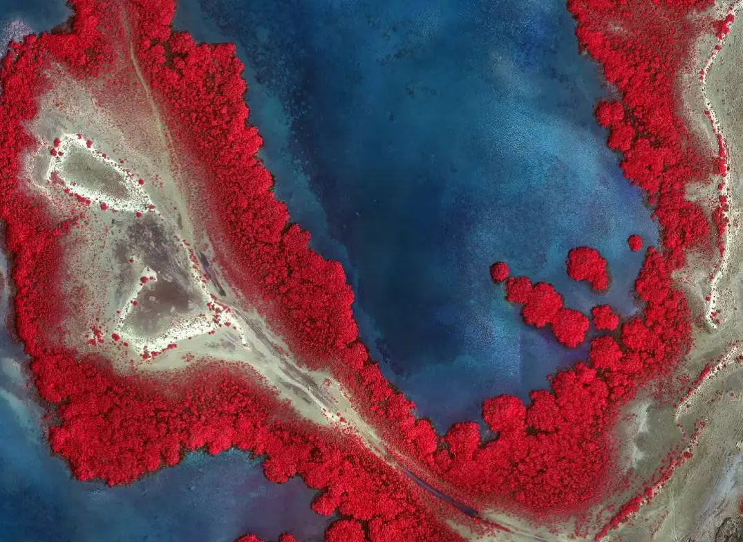
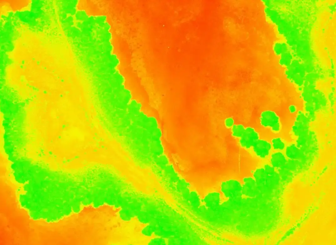
One of the key uses of drones in agriculture is to provide farmers with information about the health of their crops. Multispectral images can assess plant health by measuring chlorophyll content, indicating how much photosynthesis is occurring. Multispectral imagery has been used in agriculture for several years, but the process was slow, expensive, and difficult to use. Now drones make it easier and cheaper than ever before.
.webp)
.webp)
.webp)
Data Analysis
Our data scientists are experts in using data analysis techniques to monitor crop health and extract many different types of mapping analysis:
- Normalized Difference Vegetation Index (NDVI)
- Soil Adjusted Condition Index (SAVI)
- Vegetation Condition Index (VCI)
- Chlorophyll Vegetation Index (CVI)
- Normalized Difference Moisture Index (NDMI)
- Normalized Difference Water Index(NDWI)
- Digital Surface Model (DSM)
- Digital Terrain Model (DTM)
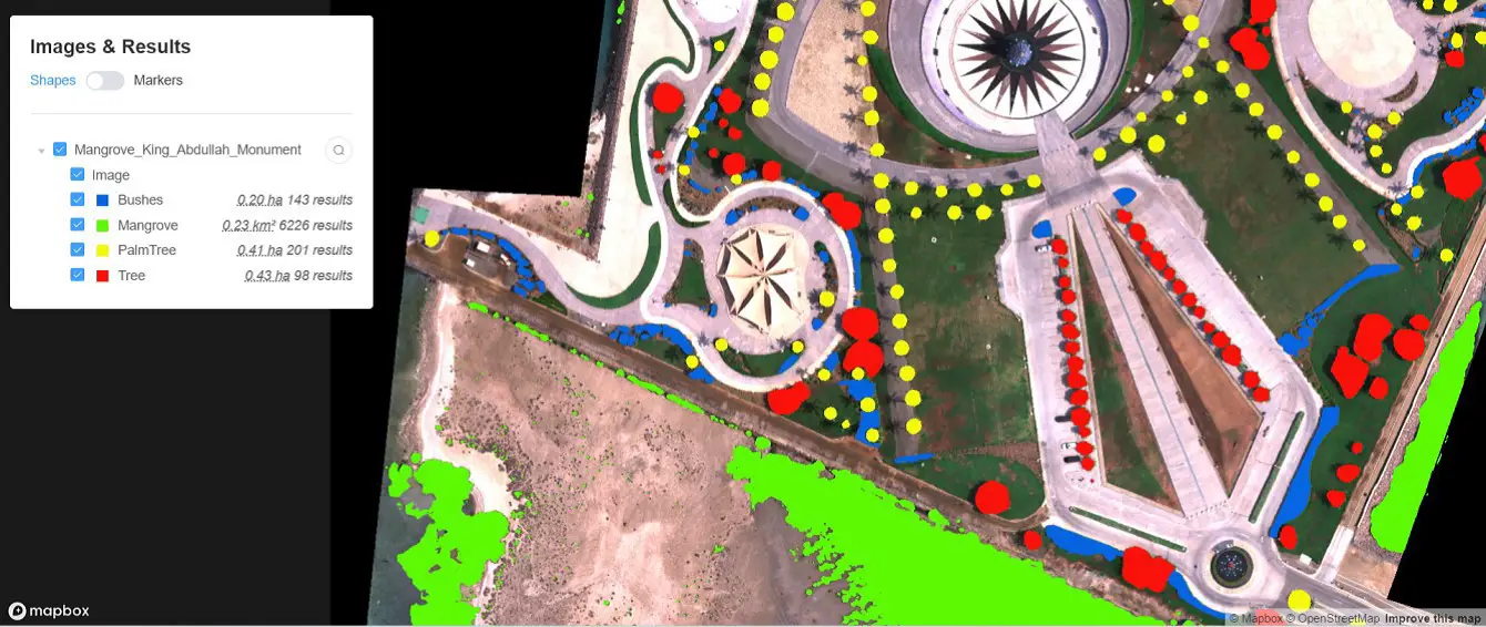
AI Solutions
- Plant Species Classifications
- Automatic Green Areas Identification
- Tree Counting and Inventory
.webp)
Revegetation and Restoration
We support revegetation and restoration projects by providing the following drone services:
- Pre-Intervention Drone Surveying
- Post-Intervention Periodical monitoring
Contact us
Get a Quote
We provide an up-front quotation on your project so you’ll know the total cost without any surprises and be in control of the cost
Get Quote