
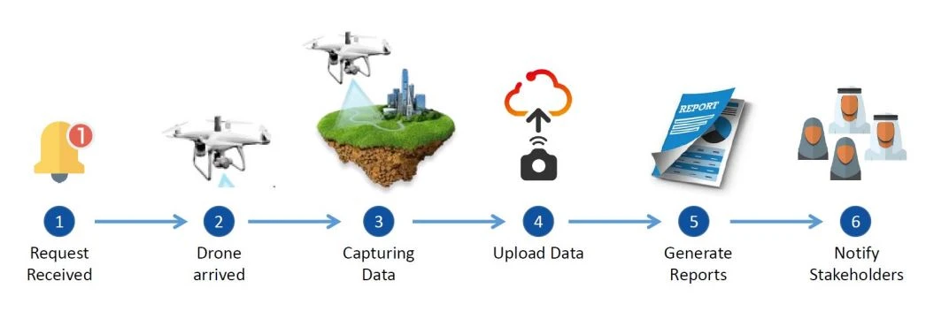
Drone Data Processing
Drone Data Processing & Management
Our value comes from Operational Manuals that allow us to achieve accurate results in data processing while overcoming many of the hurdles other companies lack the experience or ability to solve. Our SAAS software allows us to handle large projects by automating data processing and off-loading data onto the cloud. We use our own software that we continually improve to meet customer needs. We have three different processing hubs in KSA, USA, and Egypt.
We have developed our own software to manage and push projects through the processing pipeline. We also have developed a modular processing structure that allows us to replace any component which will lead to fewer errors and decreased processing bottlenecks.
We also have integrated all our workstations into a 10GBE network infrastructure so that we can parallelize processing across our entire workstation cluster. We continue to expand this cluster with more computers as the demand increases.
Deliverables
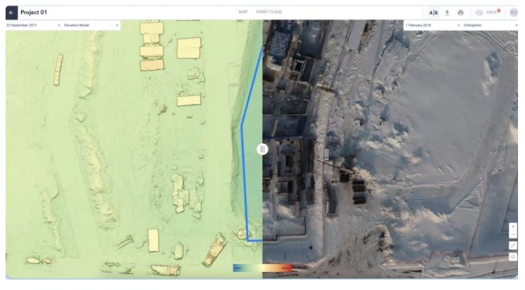
High-Definition Orthophoto
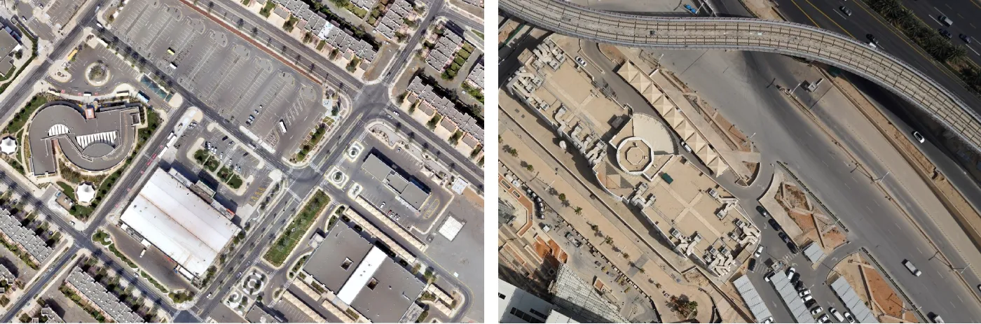
Aerial map photos provide up-to-date ortho-rectified images of the whole area. A resolution of 2.0 cm/pixel is achieved with 10X the resolution of satellite imagery. All aerial images are pre-sorted, color balanced, and sharpened to produce dynamic eye-catching images. The orthophoto is sufficiently accurate to allow measurements to be taken from the image.
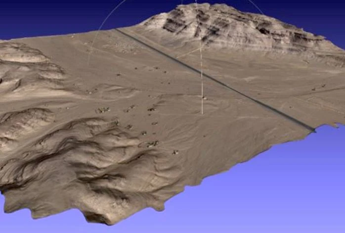
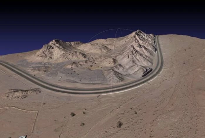
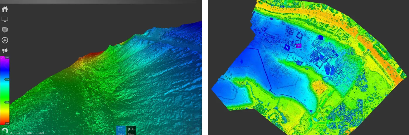
Digital Surface Model (DSM)
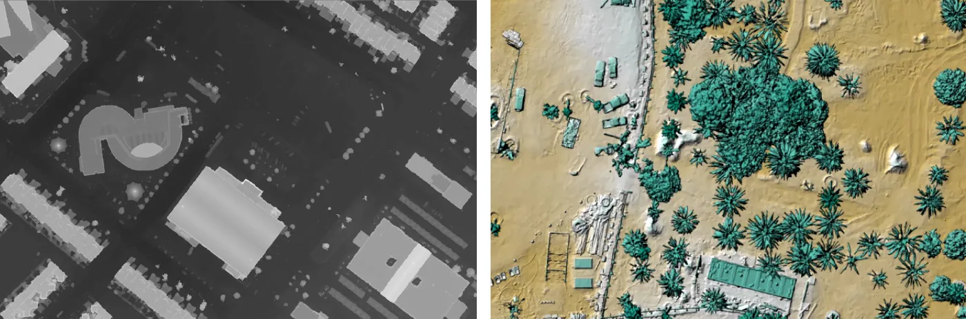
DSM's measure the height values of the first surface on the ground. This includes terrain features, buildings, vegetation, power lines, etc. DSM's provide a topographic model of the earth's surface. DSM's can be used to create 3D fly-throughs, support location-based systems, and augmented simulated environments.
Digital Terrain Model (DTM)
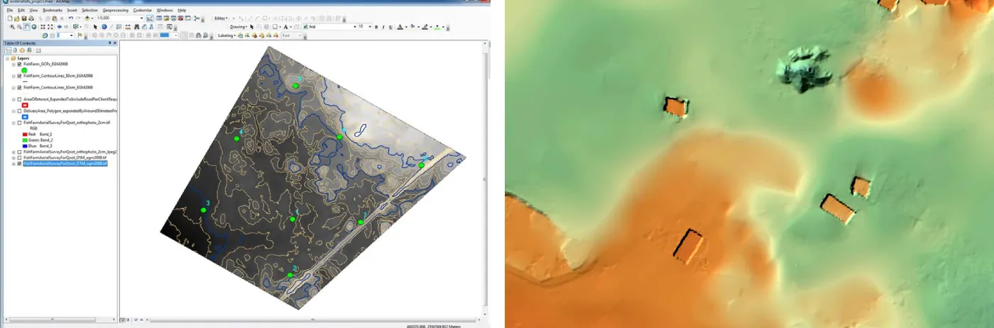
Our Digital Terrain Model (DTM) is processed at maximum resolution and accuracy. We can export different surface resolutions up to 1m cells. The data is compatible with:
- ESRI-ArcGIS
- Cesium
- AutoCAD/MicroStation
2D CAD Master Plan
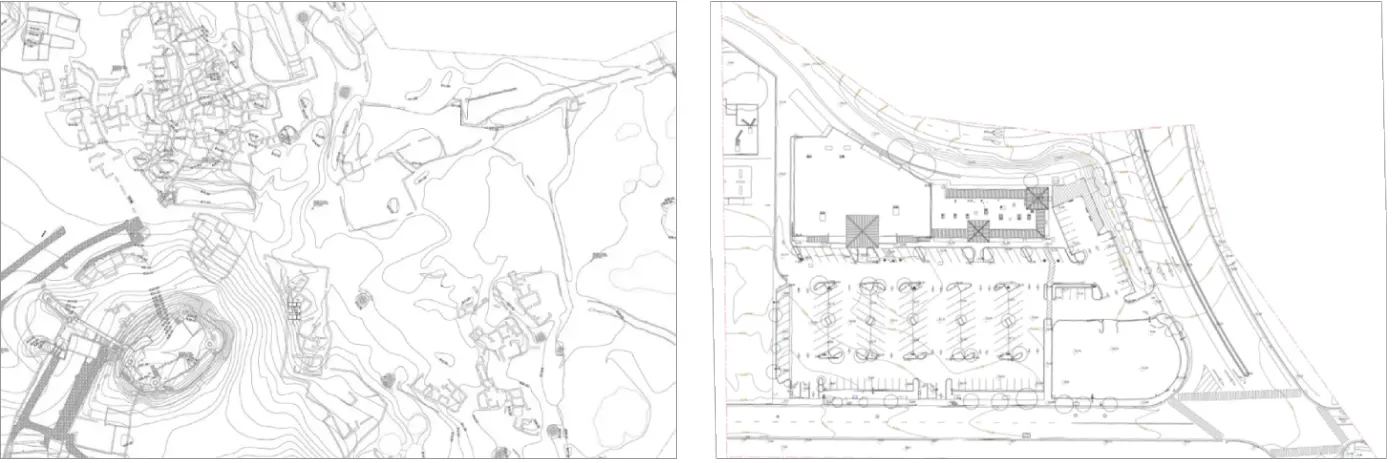
Our architects and CAD draftsmen are able to produce all linework necessary to achieve highly
accurate 2D master plan drawings (digital Civil AutoCAD plot) including contours,
spot elevations, boundaries, and GCP mark positions.
Features such as light poles,
trees, existing buildings [if any], manholes, and any exposed elements that can be clearly
seen are traced.
Contour Map
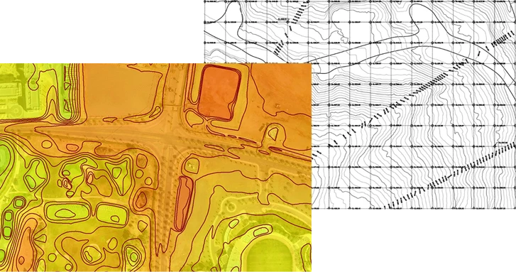
Contour lines are created from an accurate DTM and beautifully show the topographic features such as hills, depressions, and slopes. Combined with orthophoto or DSM/DTM, contour lines are a great way to visualize the topology while analysis and other visualizations can be derived from the underlying DTM data. Mapping software allows the data to be interactively explored and analyzed.
3D Mesh Model
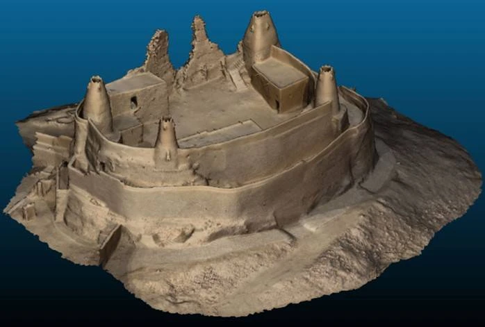
We provide a very highly detailed 3D photorealistic mesh. The 3D mesh is geo-referenced with very high accuracy. The final delivery format is a georeferenced .obj file with textures and a .mtl file. The mesh is generated from Pix4D software.
PointCloud
We provide processed high-density true colored point-clouds in LAS format.
Surveying Report
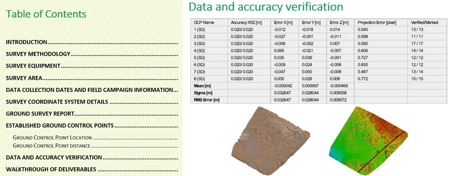
We generate a complete detailed Aerial Survey Report and Land Survey Report. The
reports detail all steps and methodologies including quality assurance and control
used to generate the deliverables.
The reports include the specifications
of the equipment used, software(s) details, methods of collection, accuracy of the
data, processing methods, collection dates, definition of the coordinate system
and coordinate conversion complete information, use of information of previous
maps, etc.
AI Analysis and Reports
We provide AI solutions by integrating drone imagery with AI analysis tools to satisfy the rapidly expanding needs in different sectors, such as Energy, Construction, Security, and Agriculture. Thanks to our expertise in artificial intelligence, FalconViz offers solutions based on drones, computer vision and neural networks like the following:
- Exterior Fixed Asset Inventory
- Traffic Counting
- Thermal Detection
- Land Registration Compliance
- Waste Management
- Construction Monitoring
- Fire and Smoke Detection
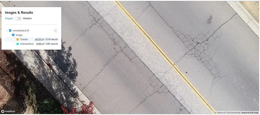
- Road Crack Damage Detection
- Agriculture and Deforestation
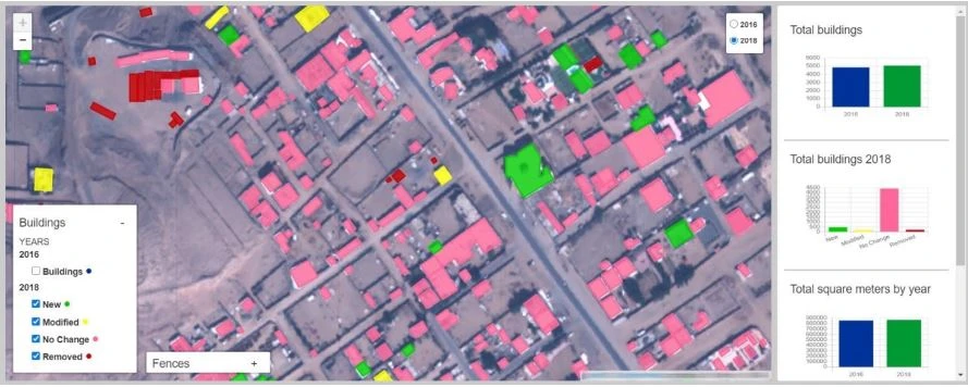
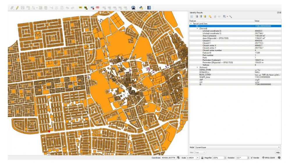
Land Registration Compliance
We are using advanced AI and an accurate and unique machine learning algorithm to automatically extract fence and building polygons from each capture and compare them to show the following features:
- New fences/buildings
- Modified fences/buildings
- Removed fences/buildings
- Unchanged fences/buildings
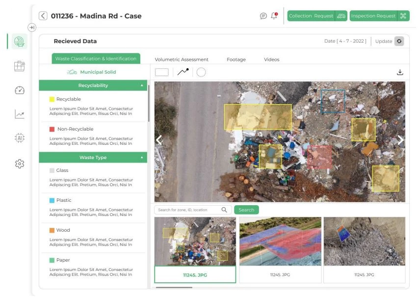
Waste Management
We are using an AI algorithm not only to identify, classify and quantify the waste from drone-captured images, but also to predict the waste location and type based on historical data. This feature can be enabled if the client would like to feed the system with historical data from relevant authorities and stakeholders
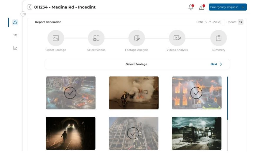
Fire and Smoke Detection
- Manage fire monitoring process
- Provide insights and forecast (proactive)
- Service provider management
- Generate intelligent reports and dashboard to control and manage the entire fire monitoring and inspection process.
- Perform planned inspection requests
- Perform urgent inspection requests
- Customize request workflows per the client situation
- Search and filtering
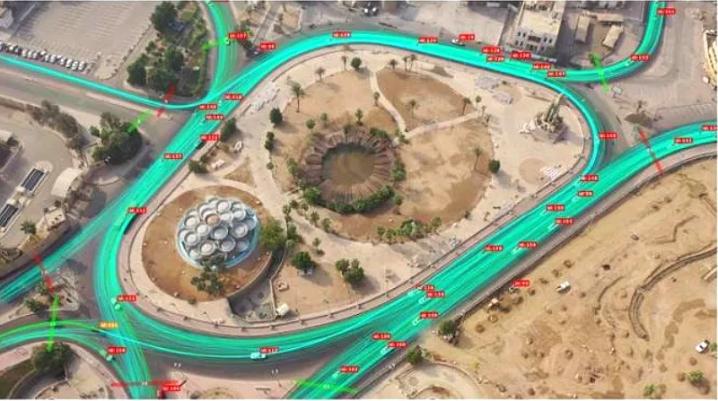
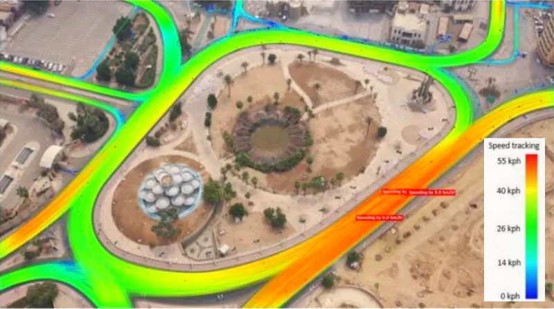
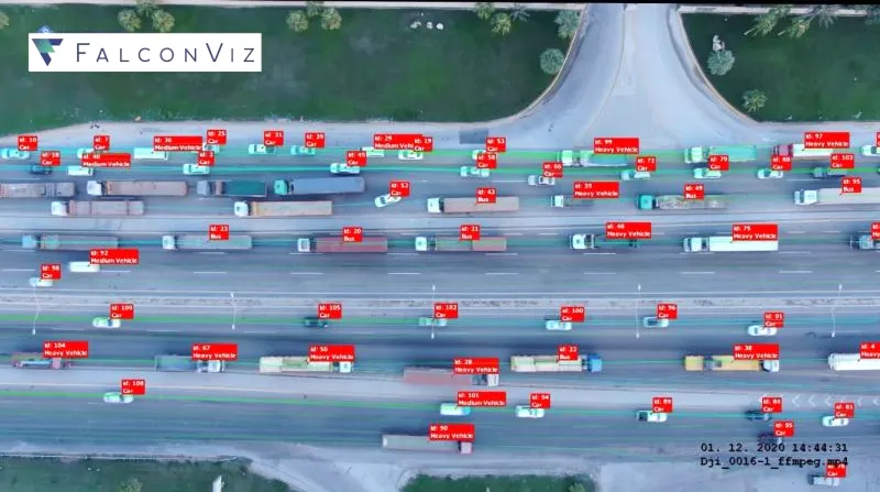
Traffic Monitoring and Counting
- Real-time monitoring drone
- Powered by deep-learning
- AI Vehicle counting, traffic monitoring
- Speed and acceleration readings
- Headways, time-gaps, safety analysis
- Delays, occupancy times, and traffic jams
- Crowd management support
- Perimeter monitoring and protection
- Augmented live-video stream
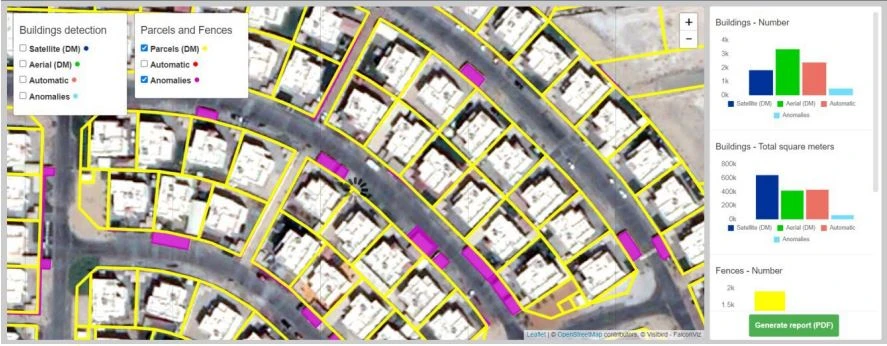
Exterior Fixed Assets Inventory
We are using advanced AI and ML algorithms to automatically detect and extract exterior fixed asset information (type, size, location)
Extracted Asset Types
- Land plots
- Buildings
- Roads (different types)
- Bridges
- Water wastewater plants
- Power substations
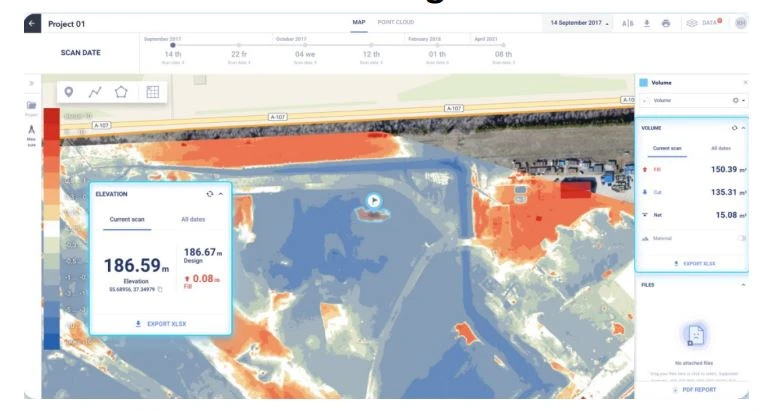
Construction Monitoring
We are using a 3D AI Construction Inspection platform that combines the latest LiDAR/Laser scanning with cutting-edge 3D Artificial Intelligence and Building Information Modelling (BIM) so that you can track, benchmark, predict, and improve the performance of your construction portfolio at scale.
This enables you to make intelligent and timely decisions, manage risks and issues with more agility, and deliver significant value for your projects.
With an all-in-one platform the client can…
- Process geospatial data from drone surveys.
- Visualize processed data without any special software.
- Analyze actual progress along with project design information.
- Manage the construction site effectively according to the platform insights.
- The platform is suitable for all the stages of the
project life cycle, including…
- Initial Project stage
- Earthwork stage
- Construction stage
- Exploitation stage
Road Crack Damage Detection
We are using advanced AI and ML algorithms that can detect and identify the shape, size, and location of cracks in asphalt roads. By applying our machine learning models to drone imagery, you can automatically identify and classify different types of cracks and erosion. This frees up time to focus on crafting a data-driven pavement management strategy.

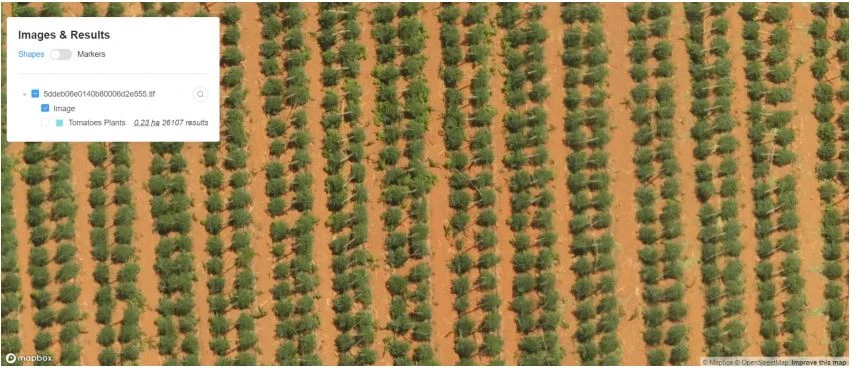
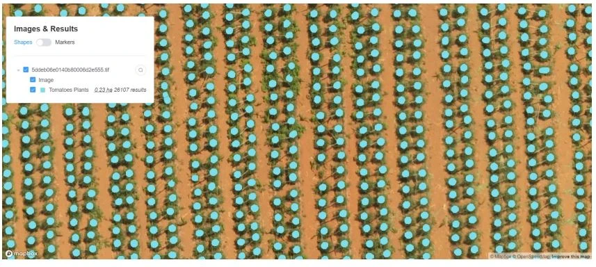
Agriculture and Deforestation
Agriculture
AI and ML combined with drone imagery are heavily used in precision agriculture. Using AI and ML technology enables us to extract the following:
- Precise crop counting to predict yield
- Growth rate analysis to understand crop stress
- Crop health analysis using multispectral sensors
- Disease detection and precision agriculture
- Custom grid overlays to fit farm layout
- Compute vegetation indices and NPK values
Deforestation
We utilize advanced technology that enables our clients to make timely localization of forest harvesting zones, something once thought to be virtually impossible, a feasible process.
We use geospatial data from different sources (satellites and drones) to train the AI model so that the results are highly accurate and achieved in a timely manner.
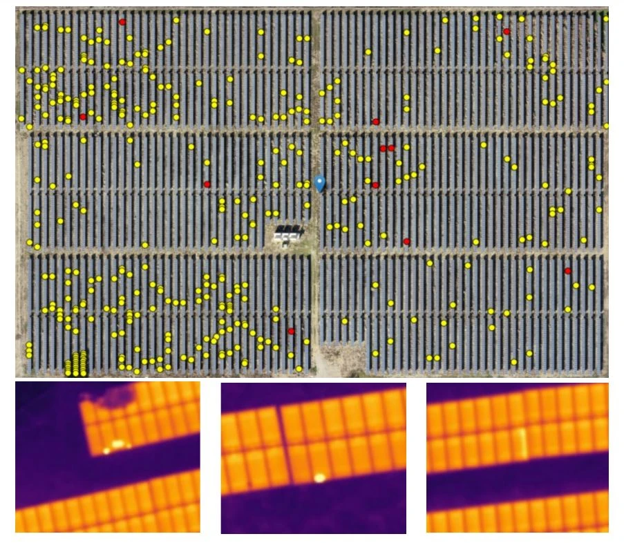
Thermal Inspection
We collect aerial data using drones equipped with thermal and RGP sensors so we can analyze the data utilizing AI and ML algorithms to automatically identify defects in solar cells installed on the ground or on building rooftops.
We generate automatic inspection reports that summarize all defects and categorize them based on their severity.
Trusted by the Following Clients

Contact us
Get a Quote
We provide an up-front quotation on your project so you’ll know the total cost without any surprises and be in control of the cost
Get Quote