
Surveying And Mapping
Surveying And Mapping
FalconViz uses cutting-edge drones and manned planes to push the boundaries of topographical surveying . We provide accurate topographical aerial surveying, up-to-date highly detailed high-resolution aerial imagery, DTM/DEM topography, CAD drawings, and 3D models with unprecedented quality and accuracy. Our accuracy is +/- 2 cm in the X and Y directions, +/- 5 cm in the Z direction.

In-Kingdom
Aerial Data
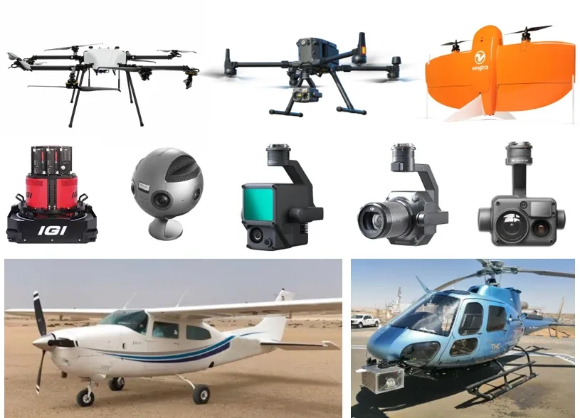
Acquisition Fleet
- VTOL Drones
- Multirotor Drones
- High-Accuracy Sensors
- Aircraft
- Helicopter
Deliverables
High-Definition Orthophoto
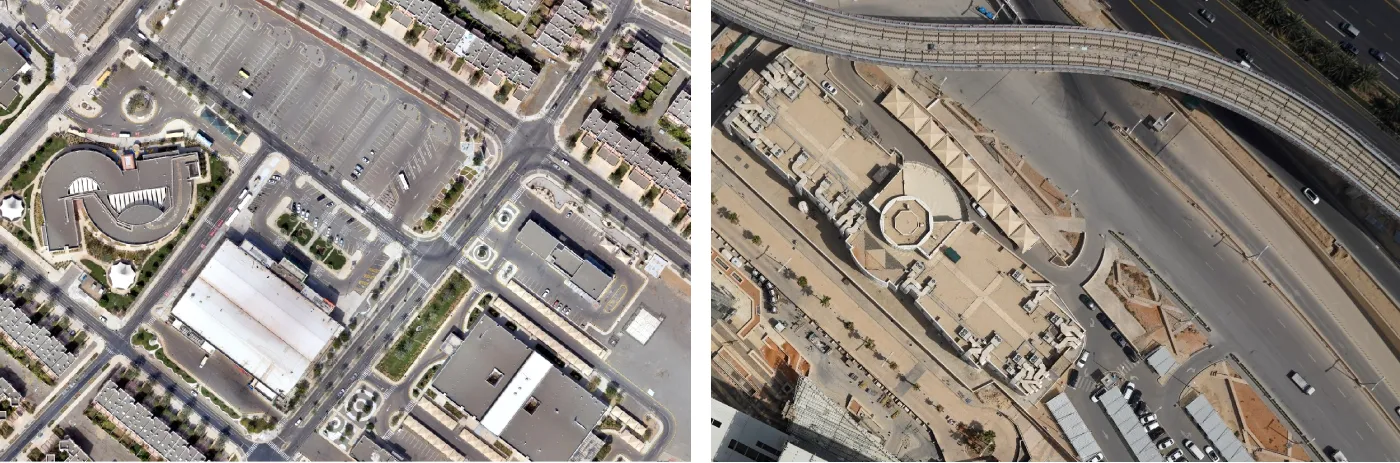
Aerial map photos provide up-to-date ortho-rectified images of the whole area. A resolution of 2.0cm/pixel is achieved with 10X the resolution of satellite imagery. All aerial images are pre-sorted, color balanced, and sharpened to produce dynamic eye-catching images. The orthophoto is sufficiently accurate to allow measurements to be taken from the image.
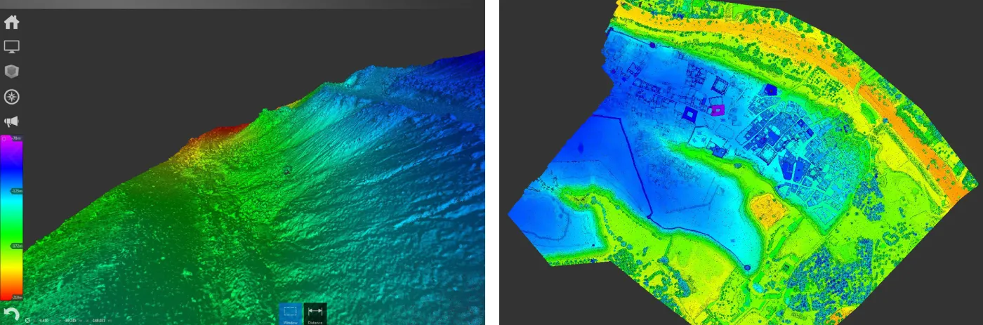
Digital Surface Model (DSM)
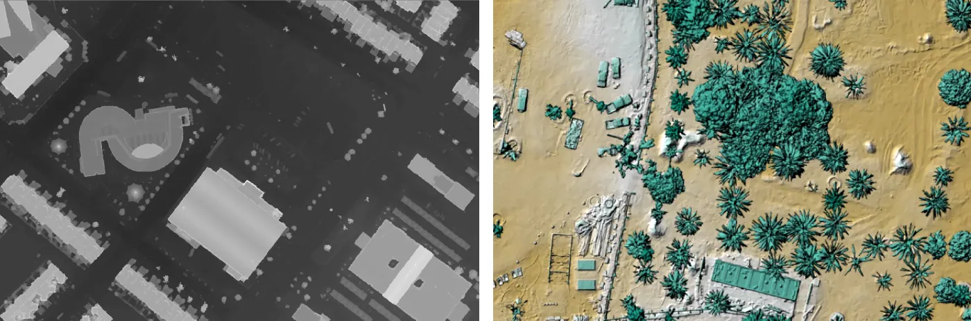
DSM's measure the height values of the first surface on the ground. This includes terrain features, buildings, vegetation, power lines, etc. DSM's provide a topographic model of the earth's surface. DSM's can be used to create 3D fly-throughs, support location-based systems, and augmented simulated environments.
Digital Terrain Model (DTM)
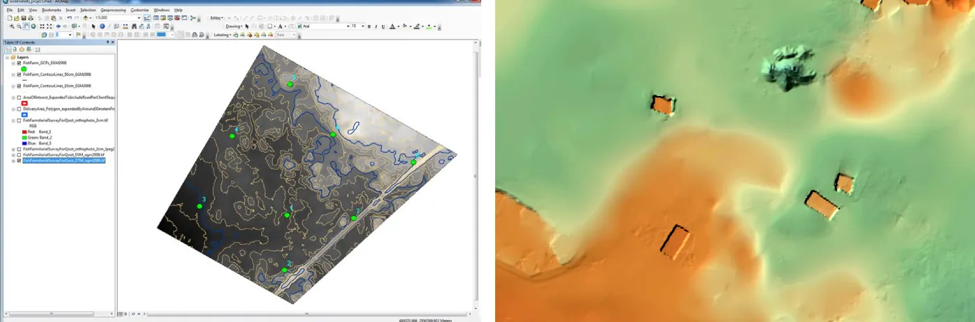
Our Digital Terrain Model (DTM) is processed at maximum resolution and accuracy. We can export different surface resolutions up to 1m cells. The data is compatible with:
- ESRI-ArcGIS
- Cesium
- AutoCAD/MicroStation
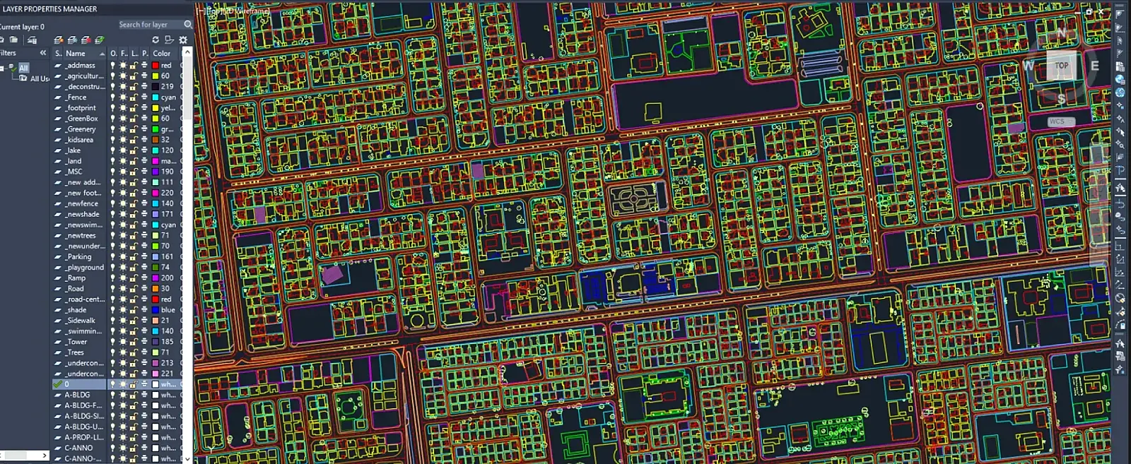
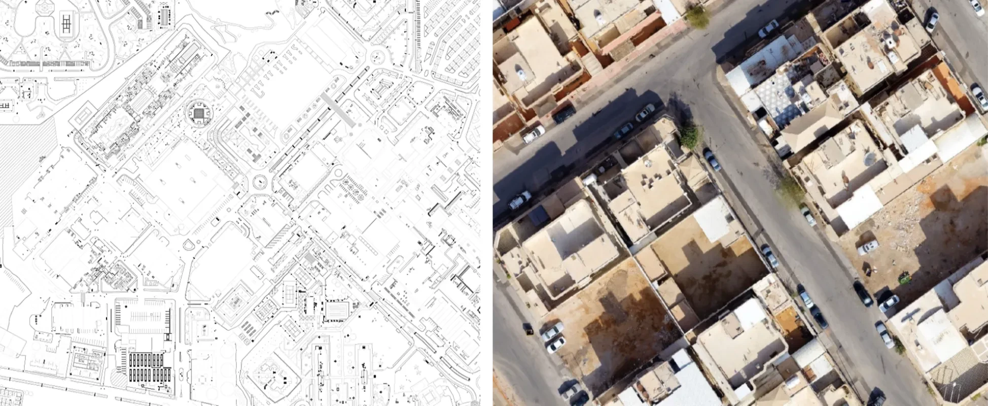
2D CAD Master Plan
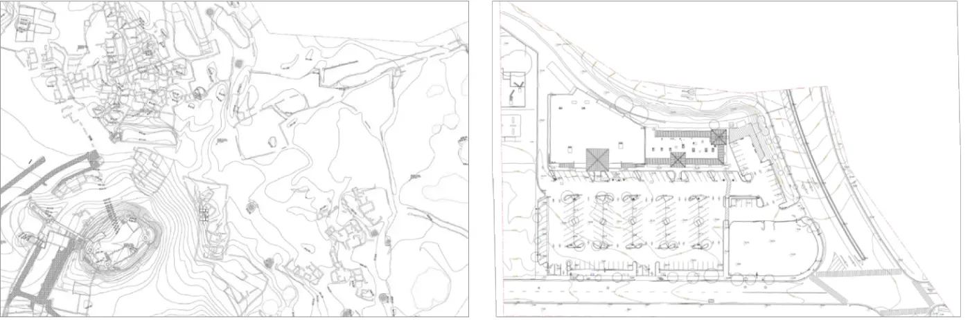
Our architects and CAD draftsmen are able to produce all line work necessary to achieve highly
accurate 2D
master plan drawings (digital Civil AutoCAD plot) including contours, spot elevations,
boundaries,
and GCP mark positions.
Features such as light poles, trees, existing buildings
[if any],
manholes, and any exposed elements that can be clearly seen are traced.
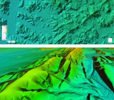
Contour Map
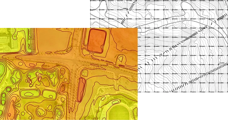
Contour lines are created from an accurate DTM and beautifully show the topographic features such as hills, depressions, and slopes. Combined with orthophoto or DSM/DTM, contour lines are a great way to visualize the topology while analysis and other visualizations can be derived from the underlying DTM data. Mapping software allows the data to be interactively explored and analyzed.
3D Mesh Model
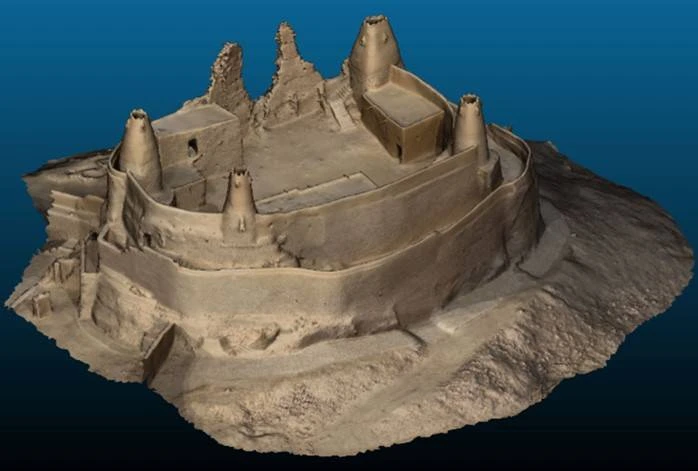
We provide a very highly detailed 3D photorealistic mesh. The 3D mesh is geo-referenced with very high accuracy. The final delivery format is a georeferenced .obj file with textures and a .mtl file. The mesh is generated from Pix4D software.
PointCloud
We provide processed high-density true colored point-clouds in LAS format.
Surveying Report
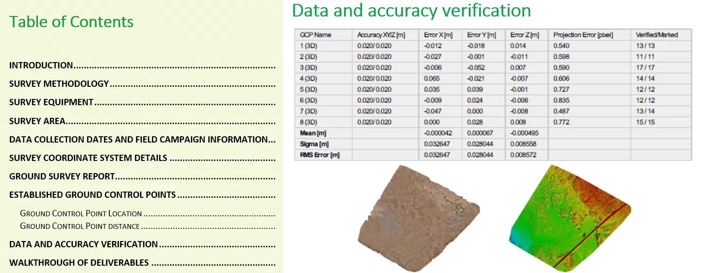
We generate a complete detailed Aerial Survey Report and Land Survey Report. The reports detail
all steps and methodologies including quality assurance and control used to generate the
deliverables.
The reports include the specifications of the equipment used, software(s) details,
methods of collection, accuracy of the data, processing methods, collection dates, definition of
the coordinate system and coordinate conversion complete information, use of information of
previous maps, etc.
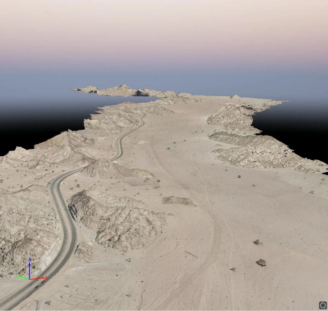
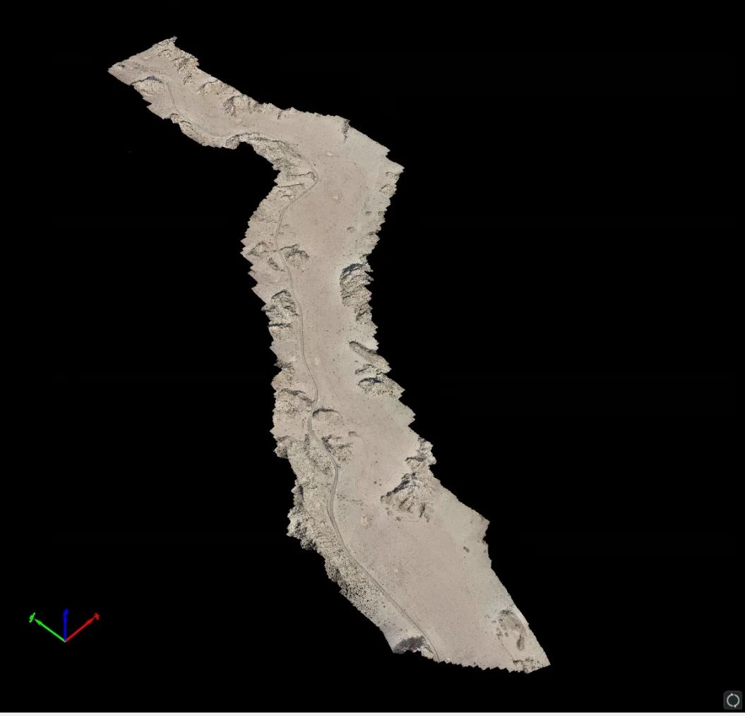
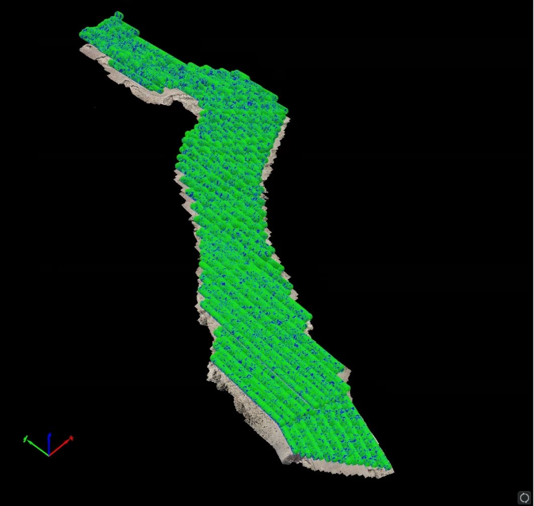
Corridor Surveying and Mapping
FalconViz provides corridor surveying and mapping services for our clients with unprecedent accuracy and resolution. Using specialized drones and surveying techniques, we reach to +/- 1.5cm accuracies in the horizontal direction, and +/- 3-5 cm in the vertical direction. For mapping, we provide high-resolution true georeferenced orthophotos with resolution up to 1.5–2 cm/pixel.
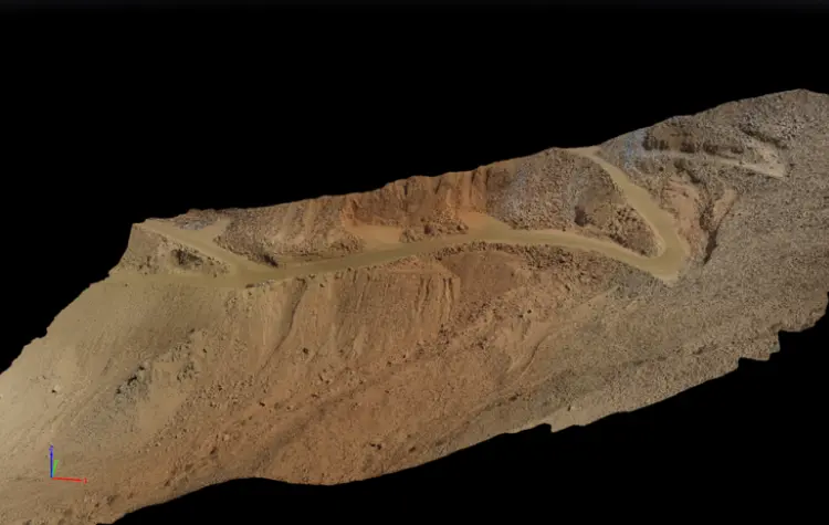
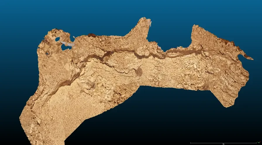
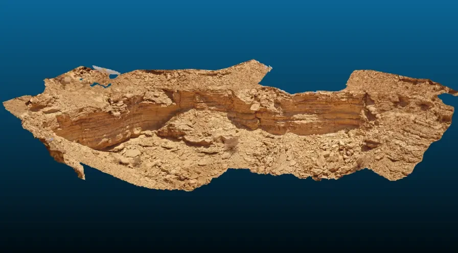
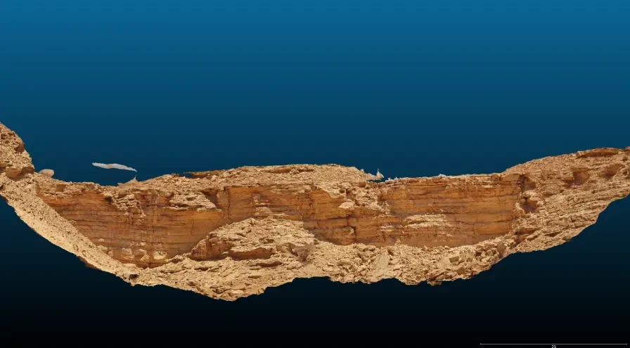
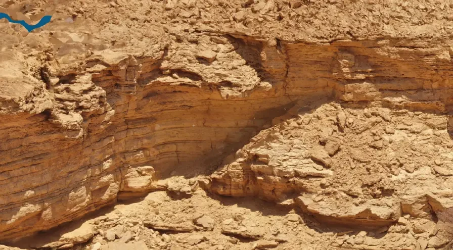
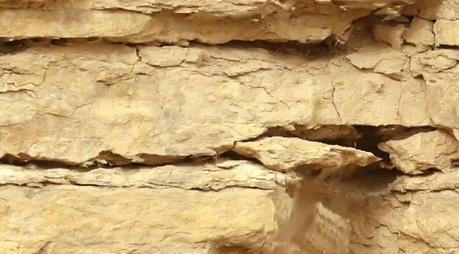
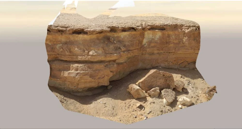
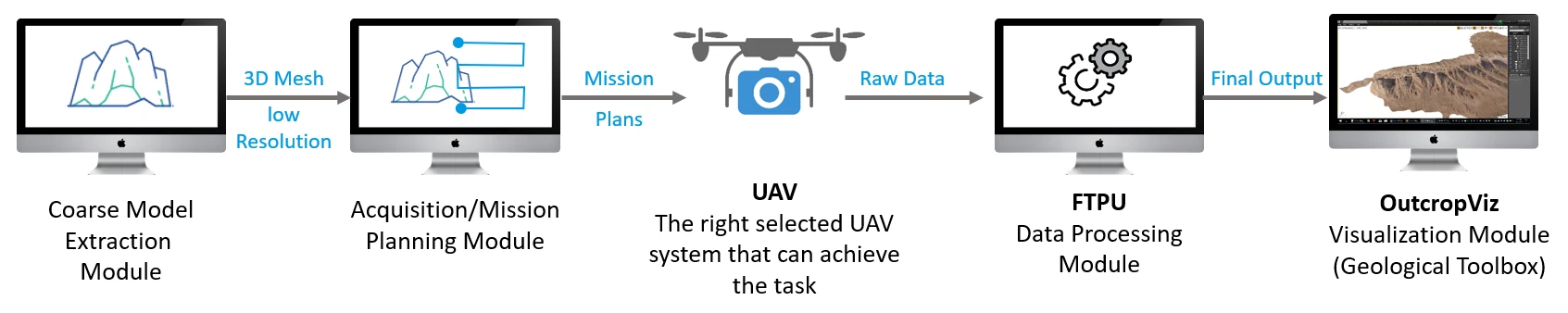
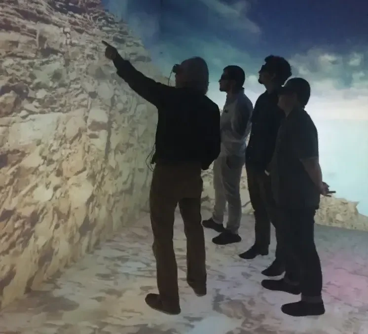
Outcrop Surveying
Vertical 2D Ortho-Projection:
- Ortho-rectified Geotiff with LOD pyramids (TIFF)
- Web map tile service online hosting/CESIUM plugin
3D Pointcloud: Pointcloud Rendering:
- LAS to Nested octree structure, or Draco Compression
- Streamable rendering using Frustrum and adjusted point size
- Examples: Potree or Cesium Ion
Mesh Rendering:
- OBJ/Collada as initial output
- Multi-Tiled Texture (4k/8K) with lower poly ( < 5 million verts) - Conversion to GITF (Cesium) and Uasset Binary (UE4)
Sample Previous Projects
Lydam Outcrop 2015
- Size : 100,000 m2
- Drones: FVH850 (2015)
- Days of Work: 6
- Resolution: 1.0 CM G.S.D Oblique
- Data Size: ~1GB
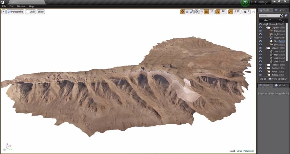
Wadi Dirab Outcrop 2017
- Size: 4 km2
- Drones: FVH850 (2015), FVJET
- Days of Work: 5
- Resolution: 2.0 CM G.S.D Oblique & Nadir, 1.0mm 3D Sections (5m wide)
- Final Data Size: ~50GB
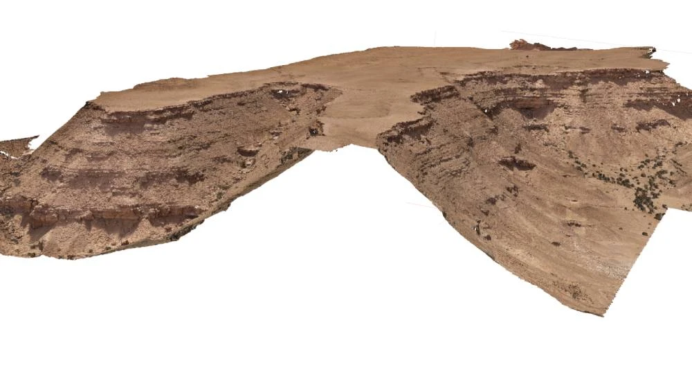
Wadi Birq Outcrop 2018
- Size: 2 km2
- Drones: FVH850 (2015), FVJET
- Days of Work: 3
- Resolution: 2.0 CM G.S.D Oblique & Nadir, 1.0mm 3D Sections (5m wide)
- Final Data Size: ~100GB
Outcrop Viz Solution
- Head Mounted Displays (e.g. Oculus)
- Augmented Displays (e.g. Magic Leap, Hololens)
- Tiled 3D Displays (e.g. 6-sided CAVE)
- Chrome Web browser
- iPad
- Samsung Tablet
- 1mm Sections to 16km2 terrain models (8K Textures, massive pointclouds, meshes, orthosections)
- Widget Menus
- Overlays
- Analytic Tools (Slicing)
- 3D Interaction Tools
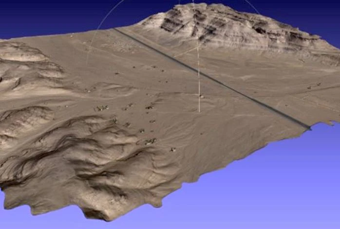
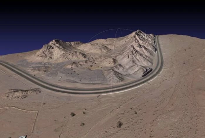
Remote Undeveloped Areas
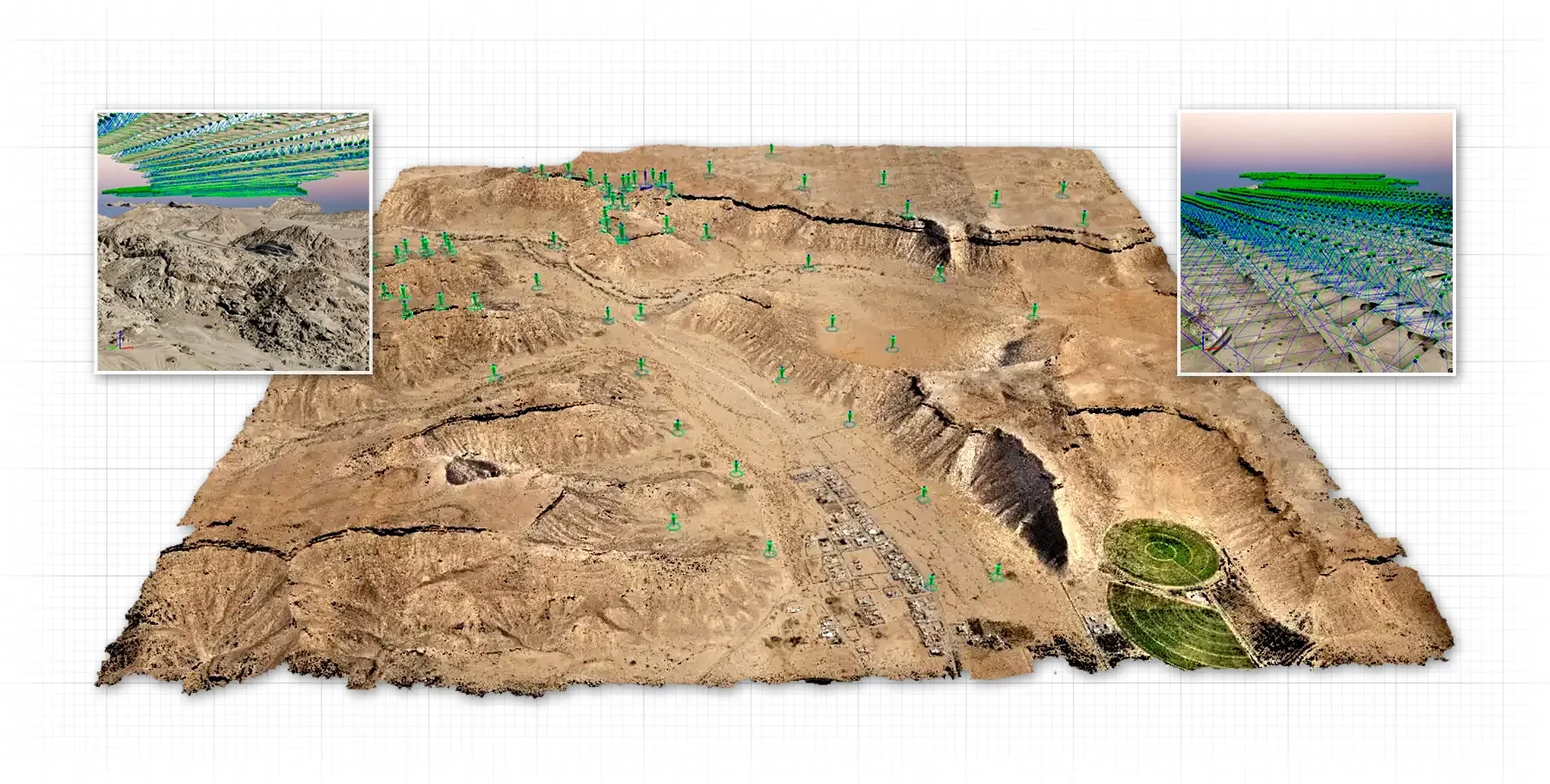
FalconViz uses drones and manned aerial
vehicles to conduct aerial surveys of remote undeveloped areas. Surveying hard-to-access and tough
mountainous areas is one of our unique competitive advantages.
Our extensive knowledge and practical experience across Saudi Arabia's different remote areas—specifically in the new mega construction projects recently
announced such in: NEOM, Qiddiya, The Red Sea, Amaala, Al Ula, etc, have given us the ability to fine-tune our methods for remote area surveying using
state-of-the-art technologies and techniques to achieve the highest spatial accuracy and mapping resolution.
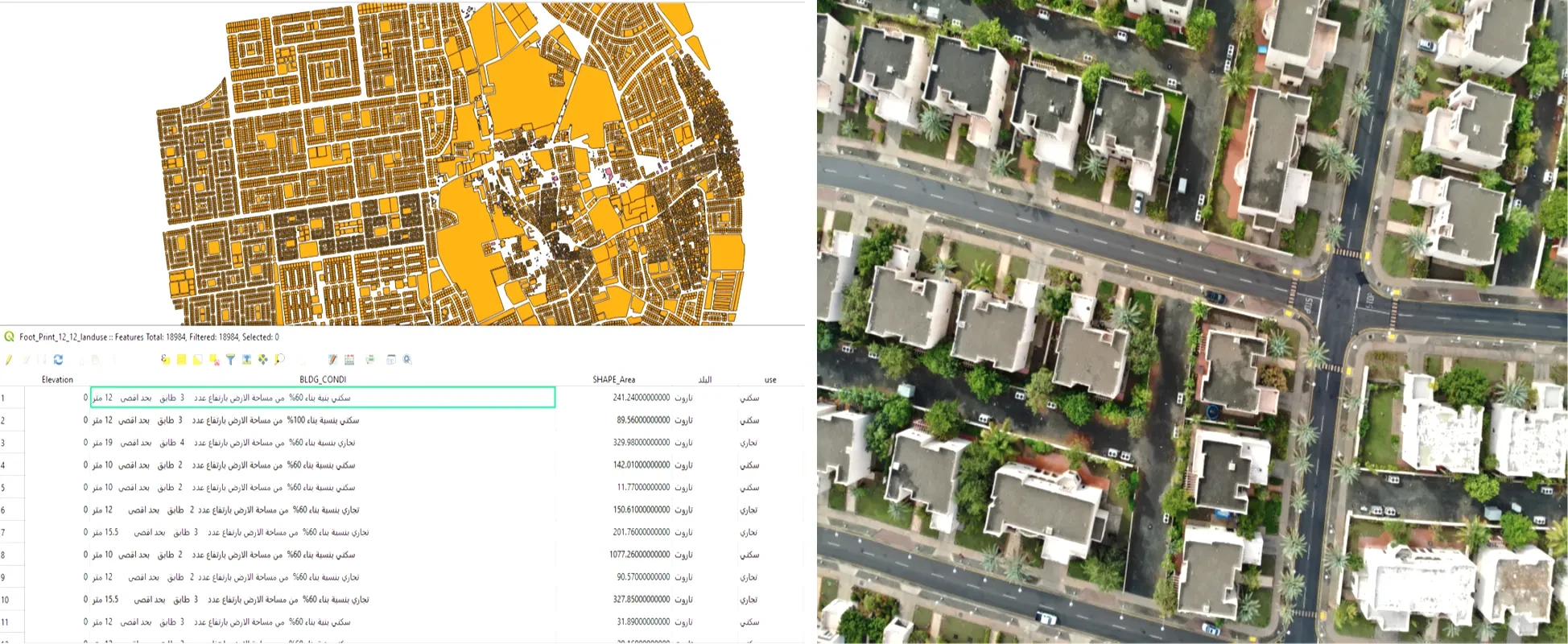
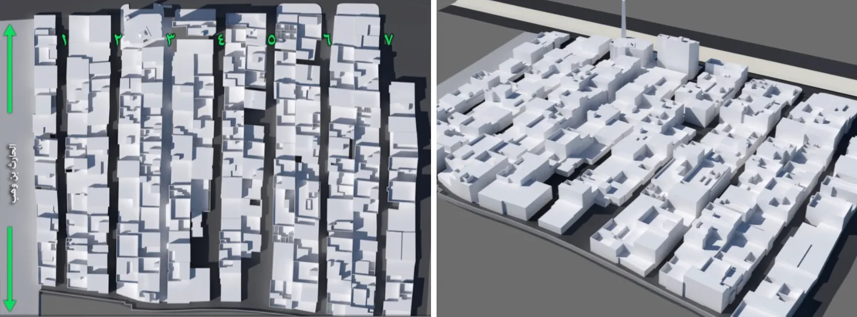
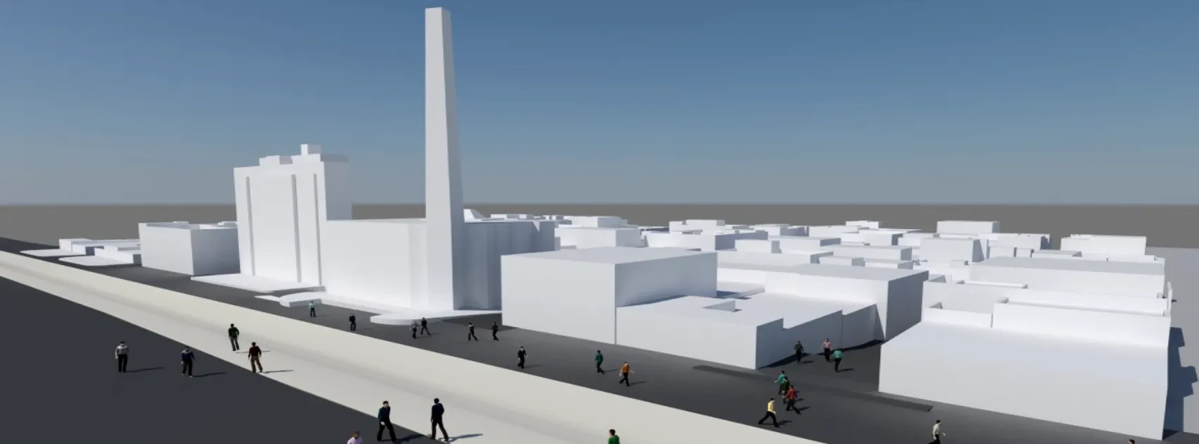
Urban Areas Surveying
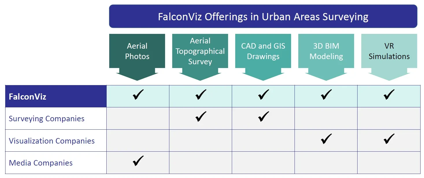
Unlike our competitors, FalconViz provides a complete
solution for urban areas surveying and mapping.
We provide our clients with high-accuracy results that help them acquire a complete 3D digital twin of their projects. We provide aerial photos and videos,
aerial topographical surveys, CAD and GIS drawings, 3D BIM modeling,
and VR simulations.
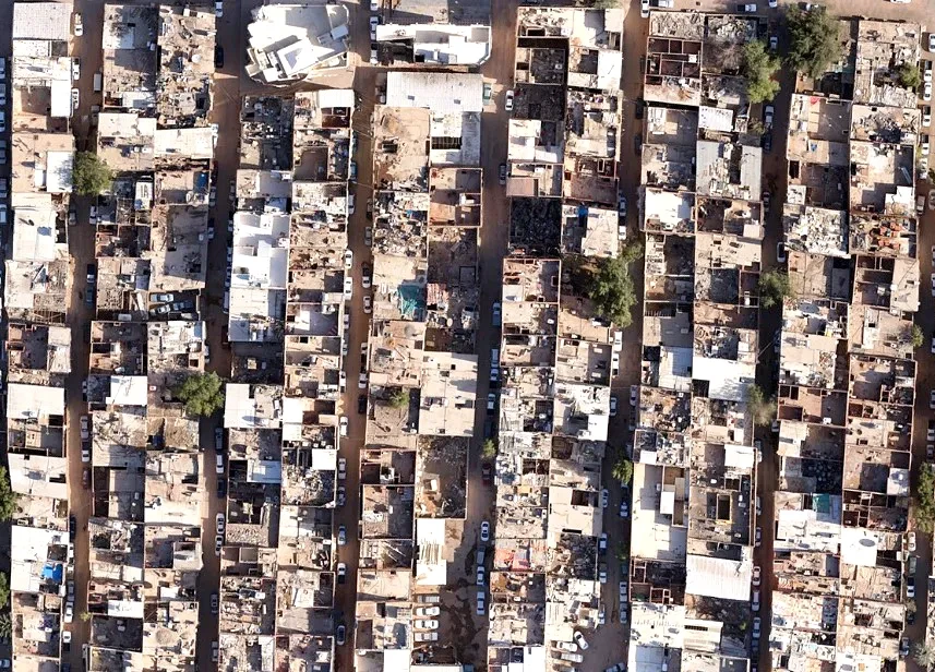
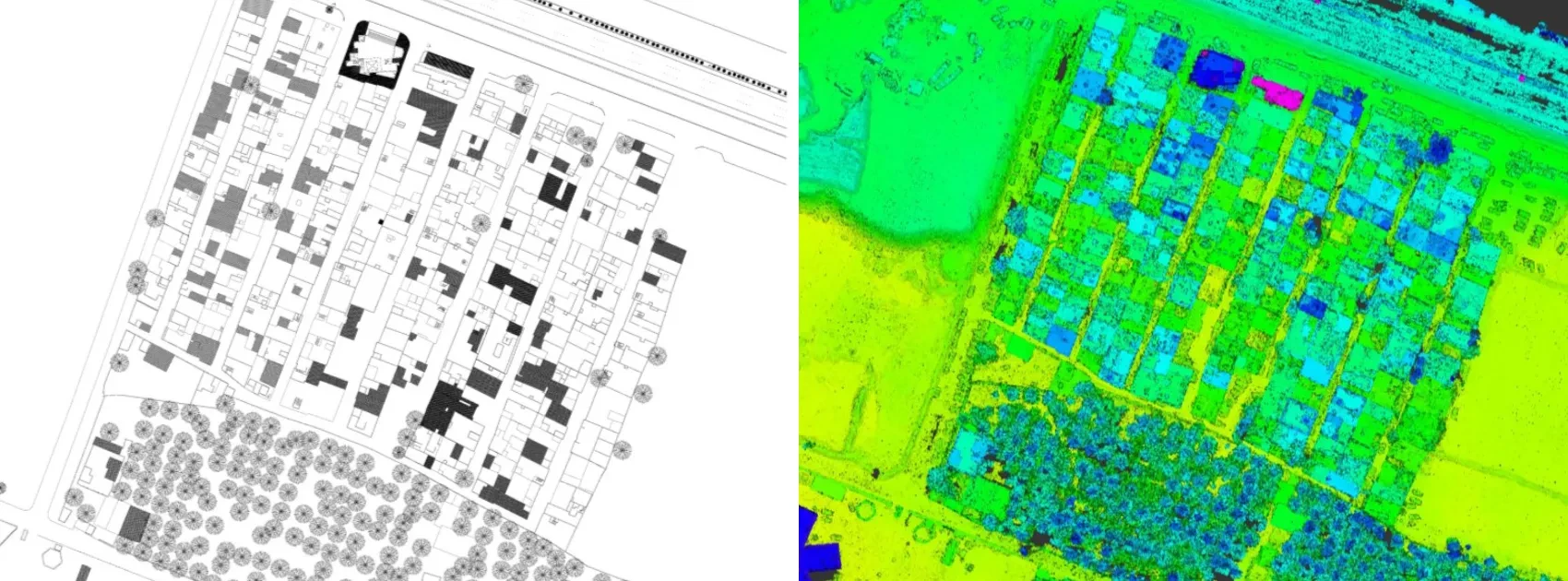
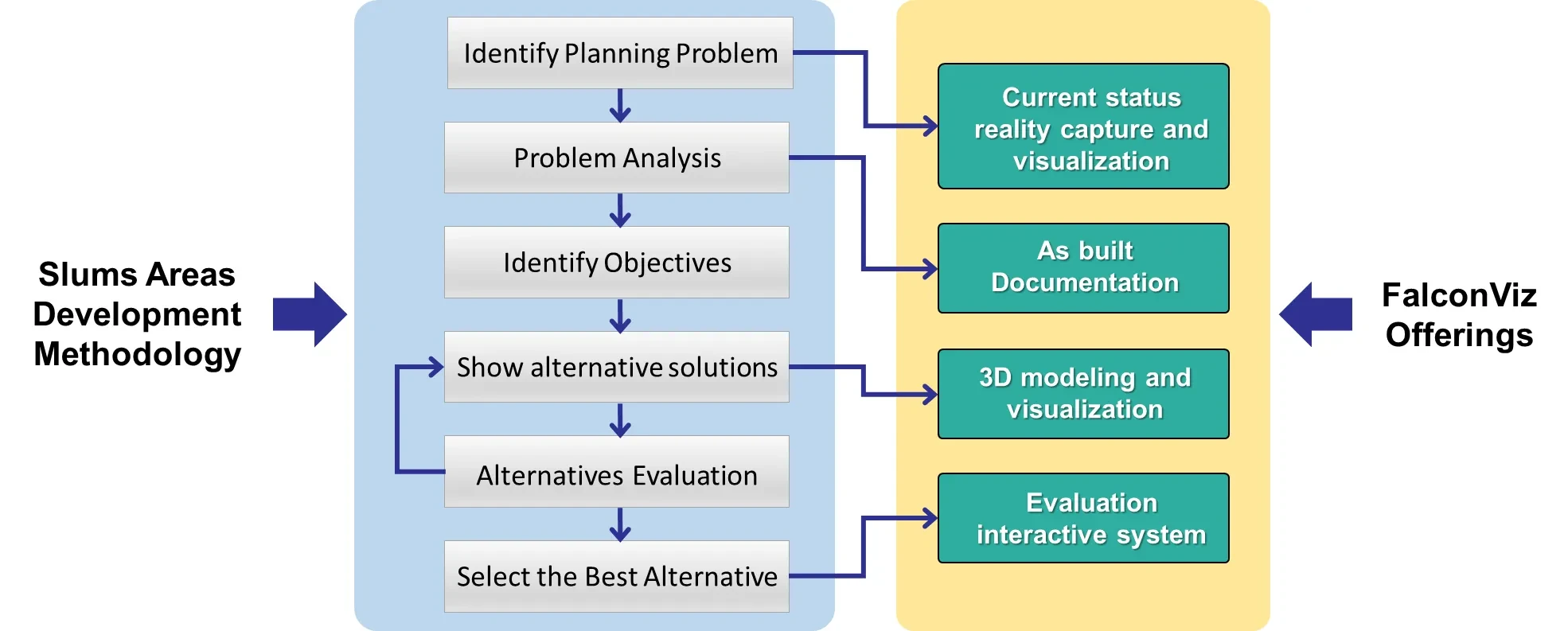
Slum Area Surveying
- In-house developed surveying solutions to conduct high-speed surveying
- High-precision surveying output
- Extreme accuracy in calculating the area and size of slum buildings allows financial resources to be optimally distributed for citizen benefit
- Aerial photography allows decision makers to study existing conditions with ease instead of guessing based on complicated engineering drawings
- Easy access to dangerous and difficult areas using drones
- Faster than traditional methods
- Competitive economic cost
Trusted by the Following Clients

Contact us
Get a Quote
We provide an up-front quotation on your project so you’ll know the total cost without any surprises and be in control of the cost
Get Quote